Anchorages in Komodo

IMG_0224

Here is a quick post with the waypoints for where Sophie stayed during our visit to the Komodo area. It’s intended for boats following in our footsteps. And as you can see from the above picture of our anchorage in Rinca, our new Navionics charts are still off by up to a quarter of a mile! Either that or a dragon picked up Sophie in the middle of the night and flew us to her nest.

Labuan Bajo – 08.30.380S 119.52.341E
We anchored a mile south of town off the beach in front of the La Prima Hotel in 50 feet of sand. It was quiet and sheltered, even in a westerly. For our first few days we left our dinghy at the beach in front of the hotel but then switched to the more convenient dinghy dock on the north side of the harbormaster’s jetty in town.

Komodo – 08.34.363 S 119.30.398E
We anchored at the top of the bay in 60 feet of sand near the cruise ship pier, which was empty. From the boat we could see deer wandering along the beach, and it was a quick dinghy ride to see the dragons, which were 200 meters from the dock. It was also a 2 mile dinghy ride to Pink Beach, which was an excellent place to snorkel.

Rinca – 08.39.220S 119.42.835E
Despite what you see in the above photo, we actually anchored in 30 feet of mud in a small bay near the National Park dock. It was a very, very protected anchorage. We were also told that crocodiles lived in the mangroves, so no swimming!

Palau Mauna – 08.33.631S 119.38.061E
This is the uninhabited island where the kids spent an afternoon playing on a beautiful pink sand beach and where Jenna and I saw a family of lionfish. We anchored off the southeast tip of the island and watched with great interest as Sophie swung back and forth in the converging currents. We wouldn’t spend the night here, but it was a wonderful day stop.

Gili Banta – 08.25.66S 119.19.557E
This was an overnight stop for us 32 miles west of Labuan Bajo. We arrived at sunset and left at sunrise. We anchored in the northernmost finger bay on the east side. The steep hills covered with grass made us think we were back in New Zealand. Very protected.

Gili Air – 08.21.948S 116.04.932E
30 hours later we picked up a mooring off the tourist beach in Gili Air. The approach from the north in the channel between Gili and Lombok was straightforward, and it was easy to follow the tourist boats through the break in the surf into the anchorage area. A guy on shore charged us ~US$5 to use his mooring for the night, which seemed like a better alternative than trying to anchor in the crowded harbor.

For all of these anchorages, we use Google Earth photos via the OvitalMap iPad app to complement our Navionics charts. It would be quite difficult to enter these anchorages for the first time without the satellite photos. The Google Earth/OvitalMap combination has become an indispensable navigation tool for us.


Bali Time

open

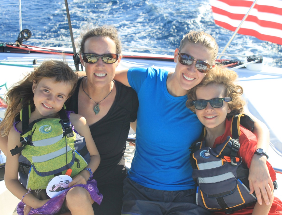
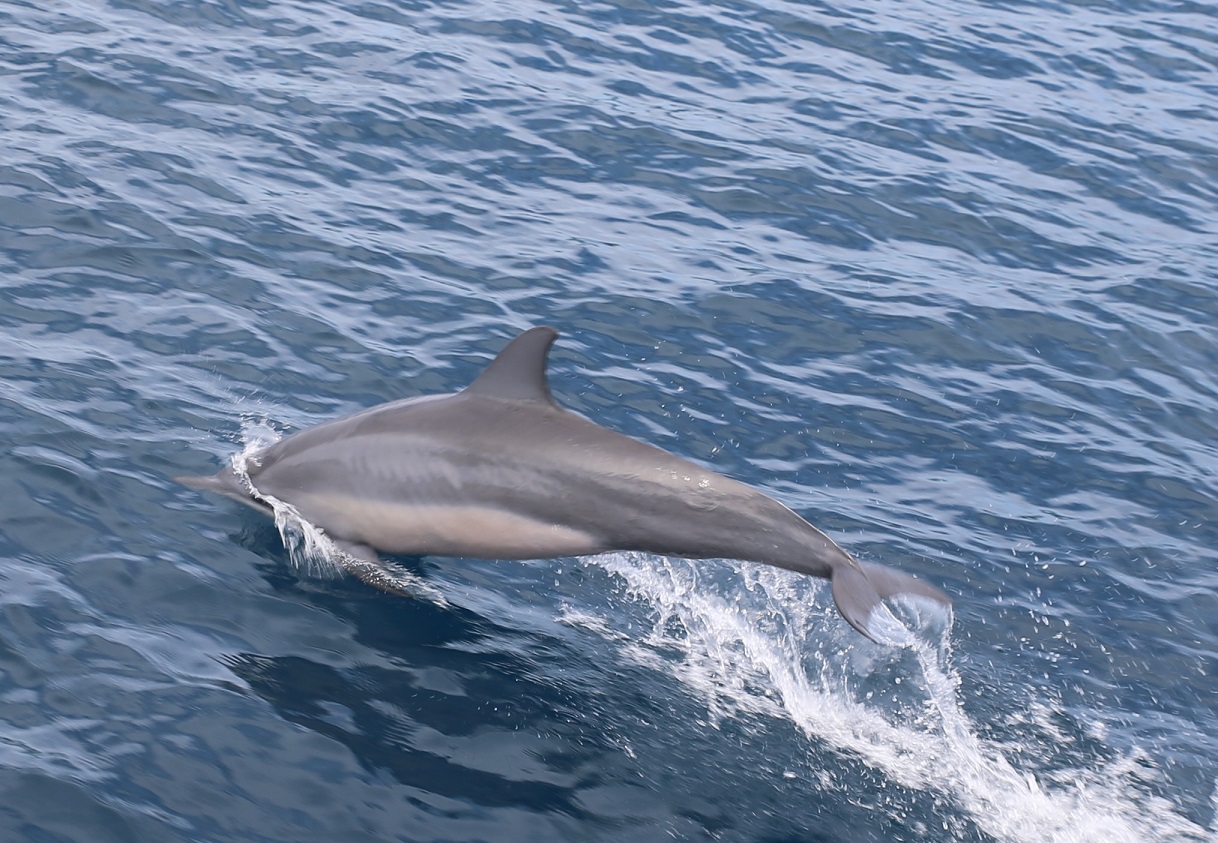
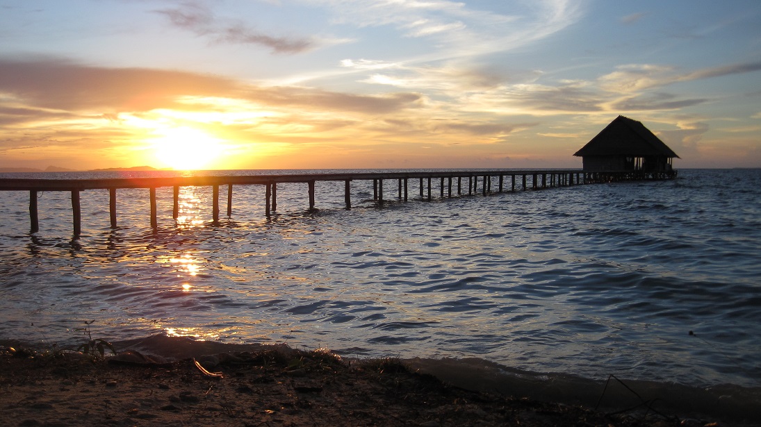
It has been a very busy two weeks for us on Sophie since we arrived in Bali. Our goal was to get here from Labuan Bajo in time for “Girls Week”, a mini vacation here in Bali for Jenna and two friends who flew out from the States for the party. We had a gentle overnight passage from Labuan Bajo to Gili Air, where we spent a night on a mooring near the beach resorts. On the next day we covered the remaining 56 miles to our anchorage in Bali in about 5 hours, thanks to a strong current in the Selat Lombok.

I’ll leave it to Jenna to document what happened during Girls Week in a future post. Needless to say, the ladies had a great time.

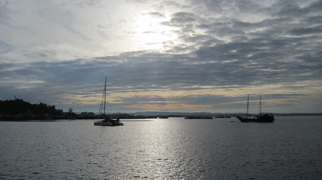
Sophie is currently anchored in Serangan, a relatively quiet fishing harbor on the northern end of the Benoa harbor area. Our current location is 08.43.127 South, 115.14.853 East. Garuça Cat is right next to us, along with 50 other boats in the harbor. Most of the boats are used for tourism.

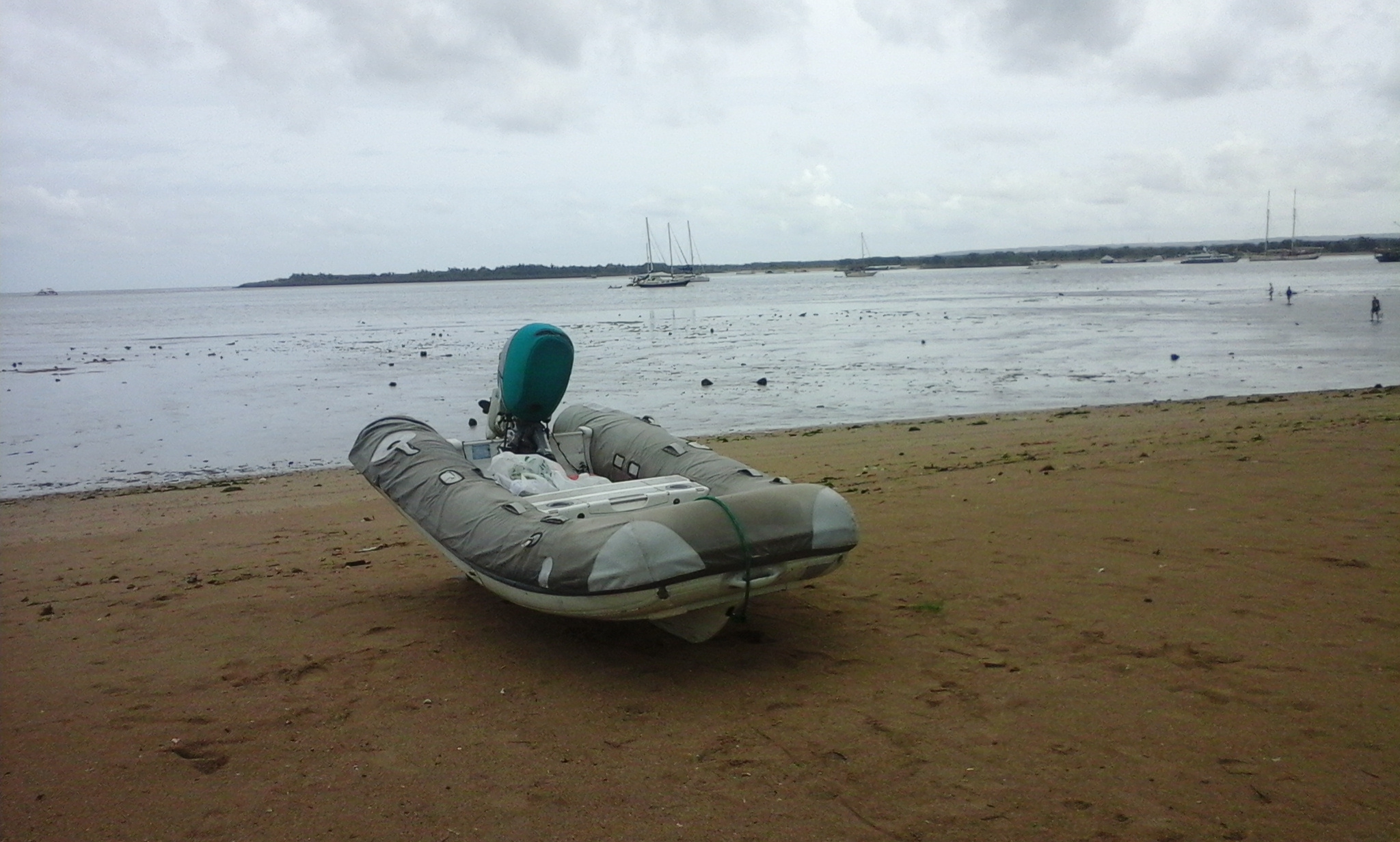
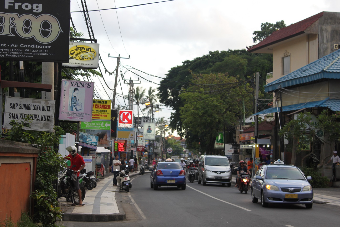
To the immediate north of us is Sanur, a relatively quiet tourist city with waterfront hotels and a strip of restaurants and tourist shops. On our first few days here, we took our dinghy up to the Sanur beach to visit the area, but soon became victim to a big swing in tides.

d1

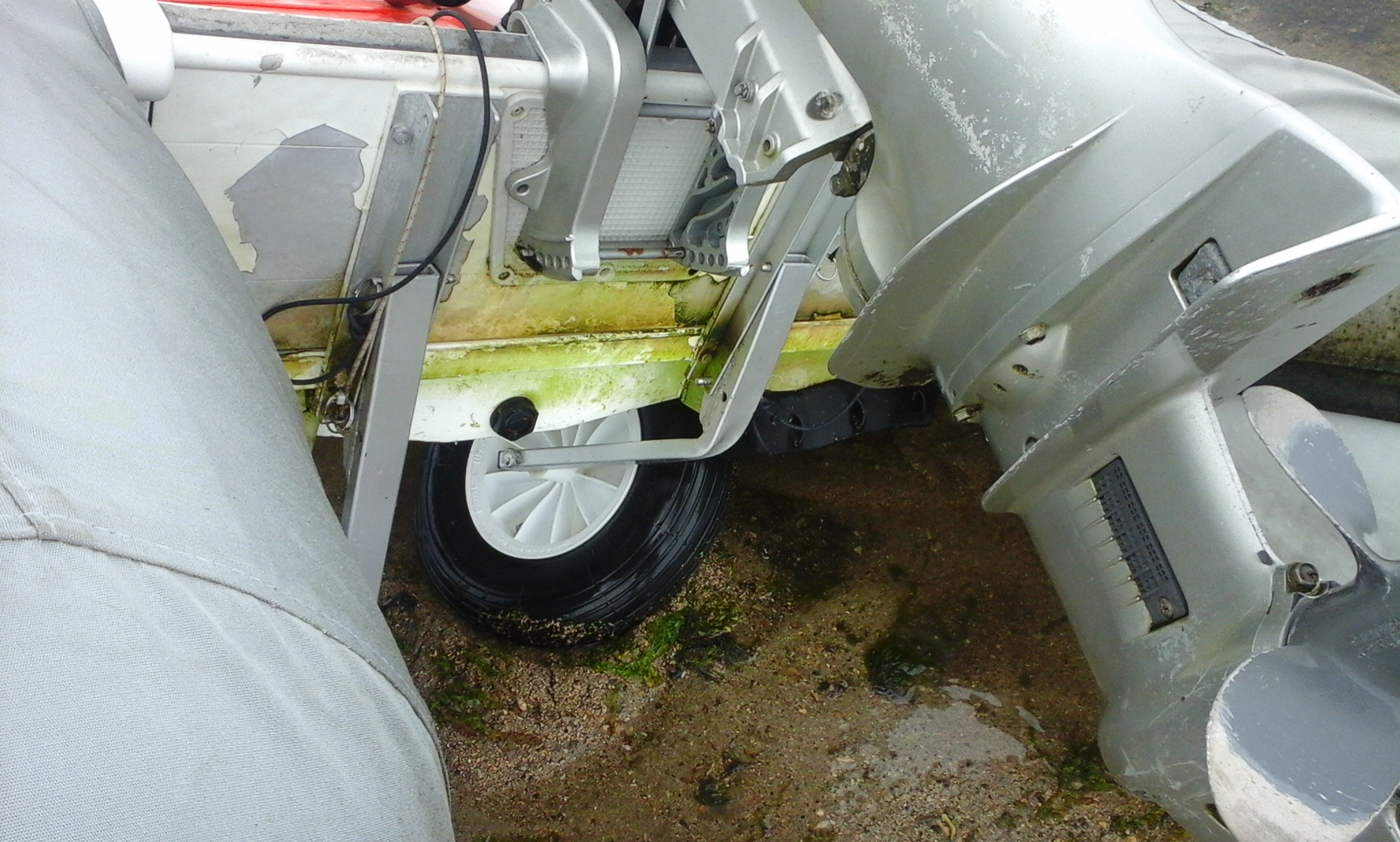
At one point while pushing the dinghy across 150 yards of muddy salt flats, the dinghy wheels buckled under the motor and failed.

d2

This happened to us a year ago in New Zealand, and we had had the aluminum wheel struts reinforced by a welder to prevent this from happening again. Oh well, no more using the dinghy to get to Sanur.

This wasn’t the only dinghy problem we encountered on our arrival to Bali. During our stopover in Gili Air, the motor stopped working. We could start it, but it would die as soon as we applied any gas. It became worse in Serangan, because by the time we got there the motor wouldn’t start at all. No motor on our dinghy could present some problems for a Girls Week where Sophie will be at anchor. I have to admit I was a little stressed and spent 5 hours working on the dinghy motor. I changed the plugs, fuel filters, and cleaned the carburetor as best I could with no luck. I finally bought a new tank of gas from a local, and that seemed to have solved the problem. But I still had to run the motor on the new gas for an hour to get it running smoothly. I have never had a problem with bad gas before, but that seemed to have been the problem in this case.

We plan to buy a new dinghy in Malaysia or Thailand, most likely an aluminum hulled Swift like the one our friends on Nalukai drive. Our Walker Bay has served us well for 7 years, but its plastic bottom is beginning to wear and the Honda outboard is showing some age. EVERYONE out here uses a 2 stroke Yamaha outboard, and a 25 horse Yamaha coupled with the new dinghy will let us get up on a plane with 7 adults on board.

While working on the engine I was also doing laundry, cleaning toilets, and getting the boat ready for 2 guests, each in their own cabin. Jenna was running Sophie School. By the time Elizabeth showed up on Friday, I was exhausted!

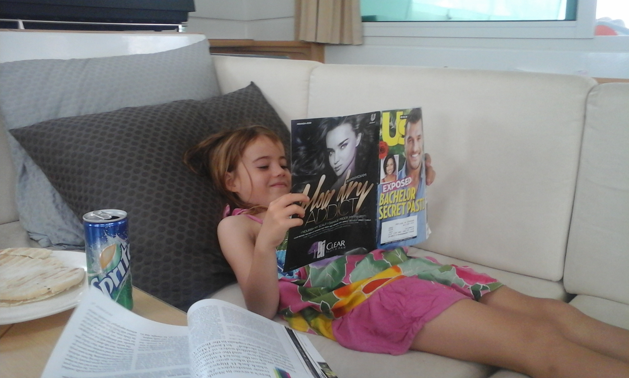
Jenna and the ladies then pretty much disappeared for the next 5 days, and I took over Sophie School and overall kid management. I am proud to say that we got three full school days in. Hazel even had the chance to enjoy some extracurricular reading.

ss1

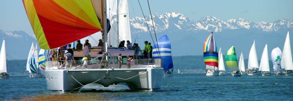
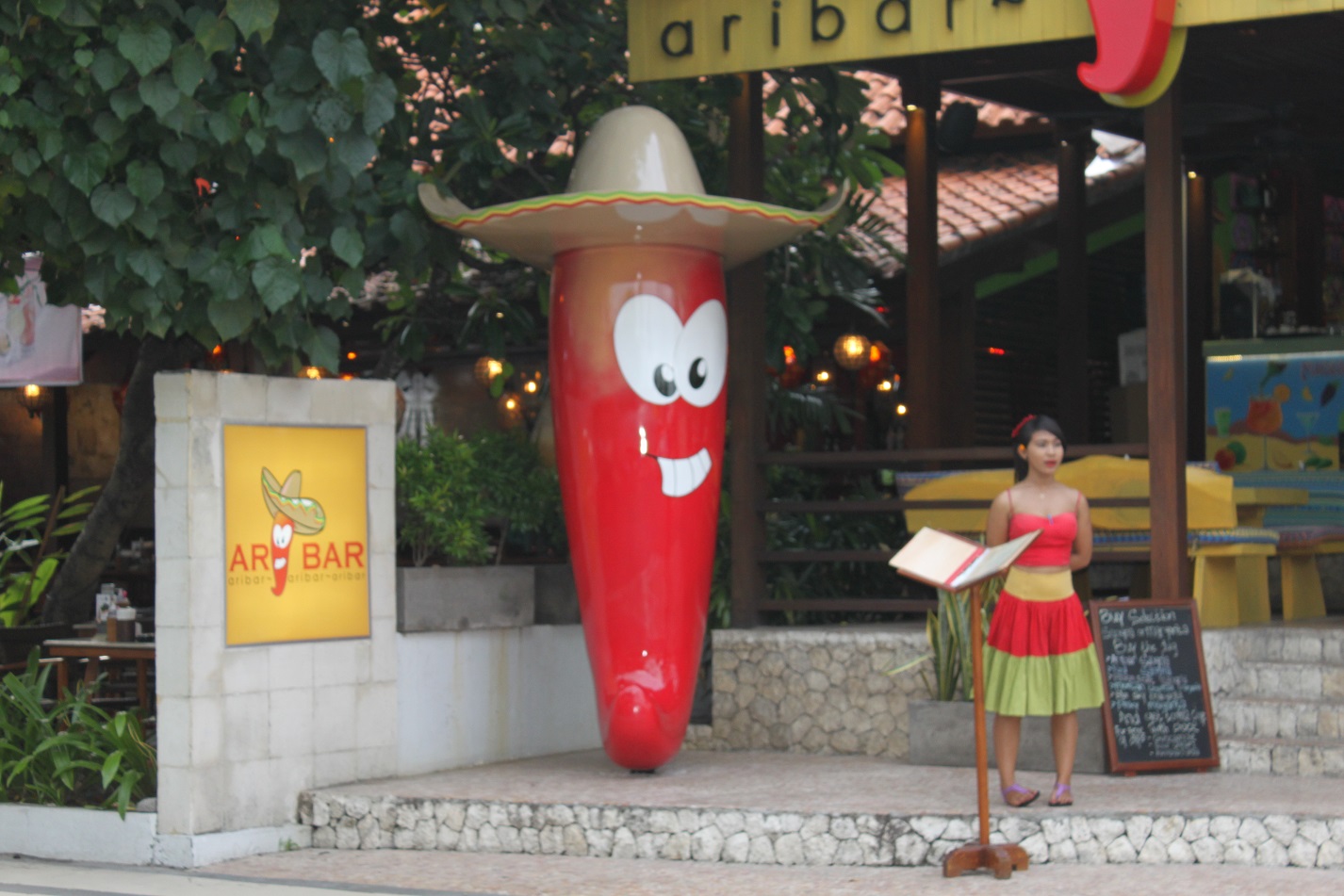
When we weren’t doing school, the kiddies and I had the chance to explore a little bit of the local scenery. We went into Sanur so I could buy a new paddle for my paddle board. While there I saw one of the sweetest rides I’ve seen on the trip.

ss5

I want one. Badly.

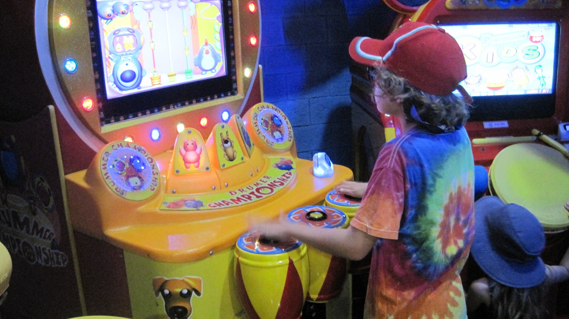
The kiddies and I enjoyed one epic day where we went to a water slide park, an open market, and then to a mall were we ate at Tony Roma’s and hung out in a video arcade.

ss3

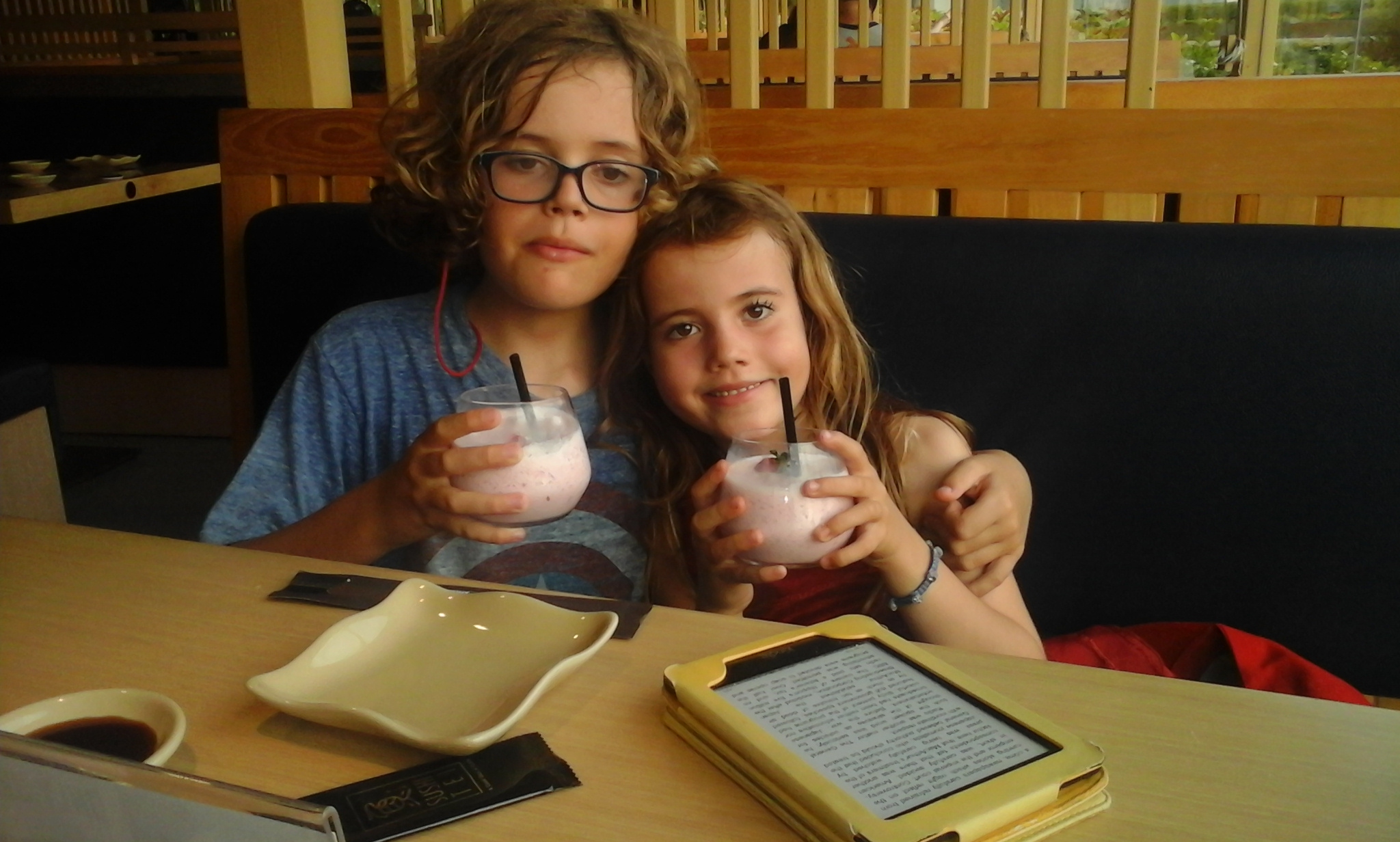
I am glad that Jenna got to enjoy a mini-vacation, because she has been with the kiddies pretty much non-stop for two years. Leo and Hazel had fun hanging out with me.

ss2

A couple of milkshakes a day doesn’t hurt morale, either. Daddy daycare rules!

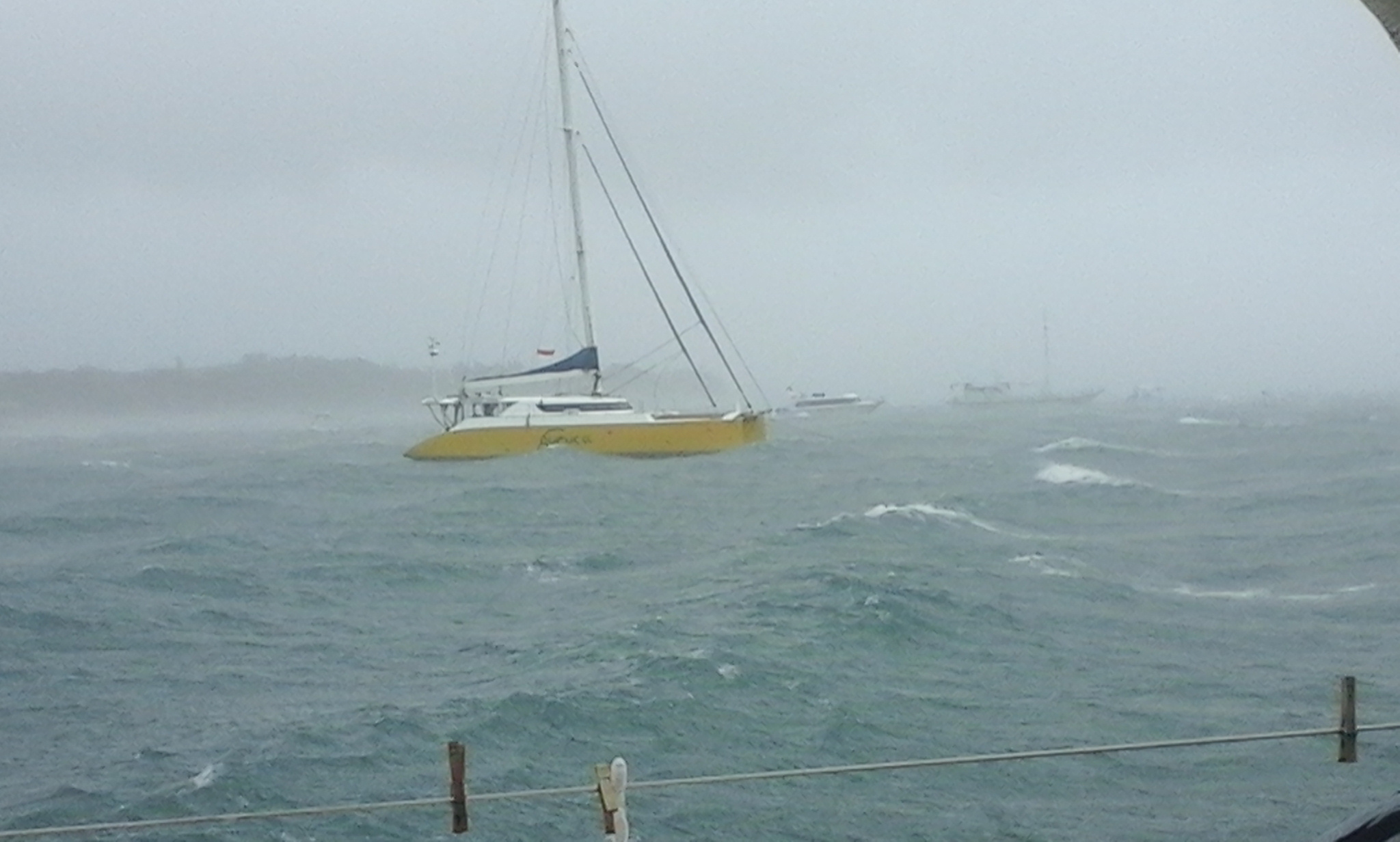
We even got hit with a nice squall. Thankfully it happened during the day, and the three of us were on the boat. Wind gusts hit 48 knots, and visibility disappeared. I turned the motors on as a precaution, but thankfully there is thick mud in the anchorage and Sophie didn’t budge. Our neighbor Guta was alone on Garuça Cat, and she was pretty scared at the time. We later learned that a couple of people in town had trees fall on them during the squall. They died. Scary stuff.

ss4

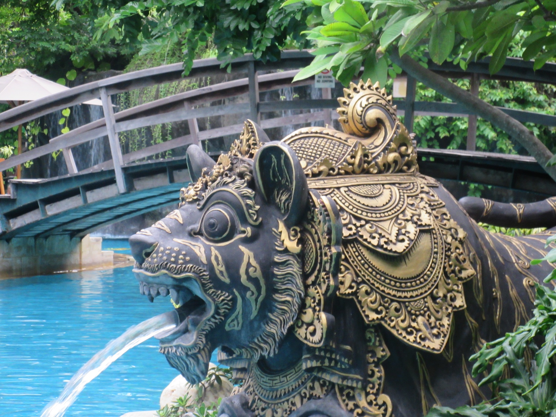
Have I mentioned yet that Bali is unlike any place we’ve visited since we left on the trip? I haven’t yet had the chance tour the interior or any of the Hindu cultural sites — we’ll do that as a family next week. But so far what I’ve seen is some weird mixture of Vegas, Disneyland, and a tropical spring break.

v1

The city areas are very crowded, and we have to take a 10 minute taxi ride to get anywhere. Thankfully the rides cost around $5, and we now have apps on our phones we can use to order cabs.

v2

There are thousands of tourist restaurants here, and some are ridiculous. But most of the ones we’ve eaten at have been quite good and reasonably priced.

v3

Most of all, people seem to come here to PARTY! Round trip flights to Bali from Australia are as low as $150, and there seem to be bars on every block. This is a far cry from Jayapura, our port of entry into Indonesia. There you heard the Muslim call to prayer on loudspeakers throughout the day, Jenna had to cover shoulders and legs while in town, and there were three places where you could buy a drink.

Dorothy, we’re not in Papua any more.

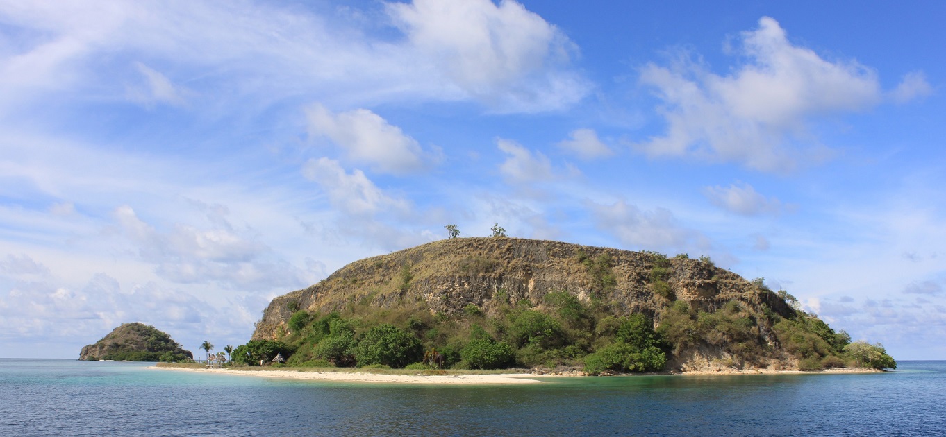
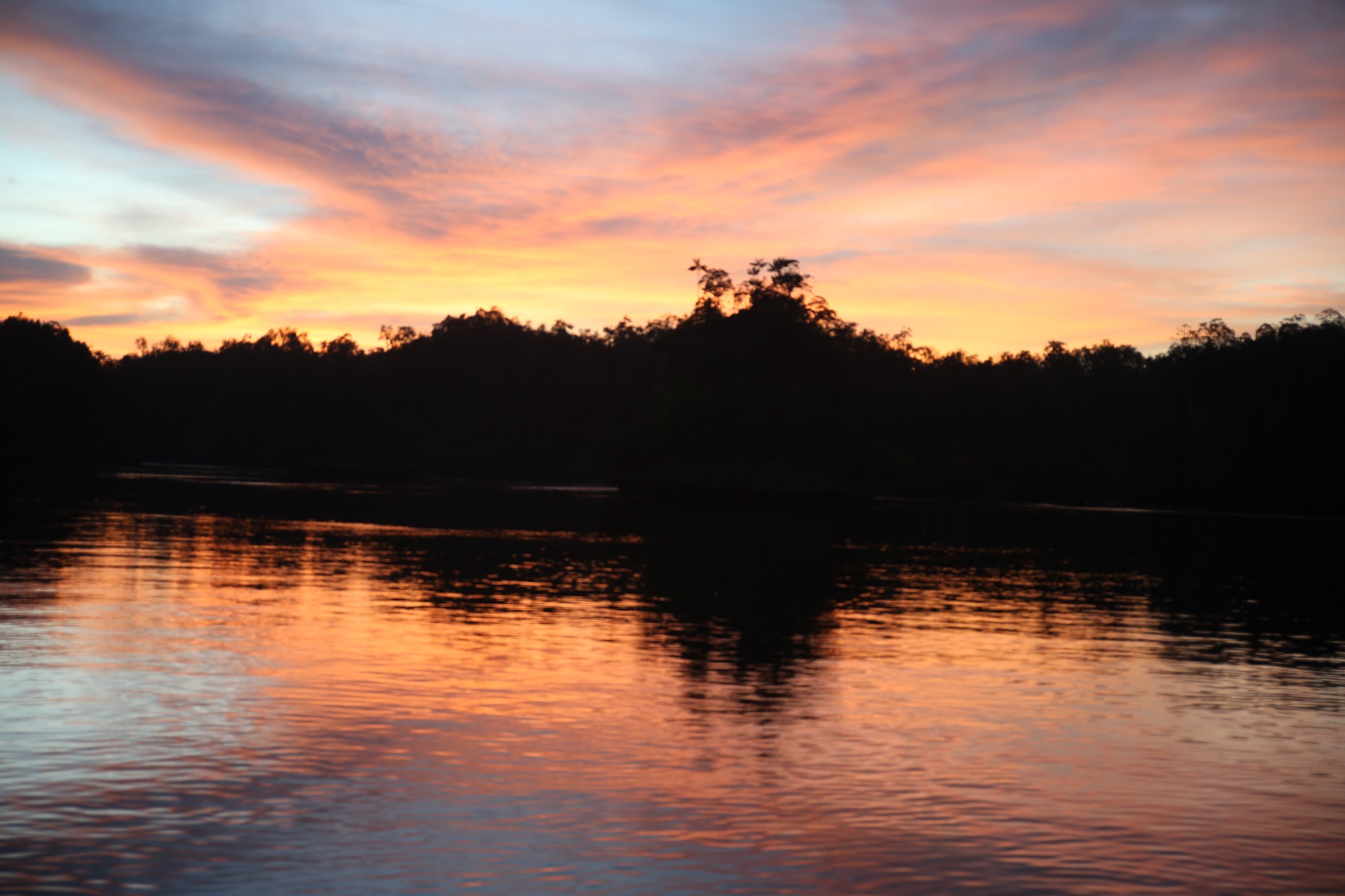
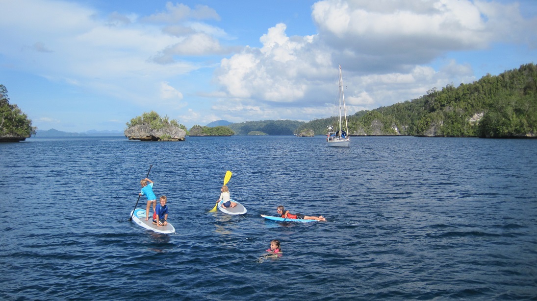
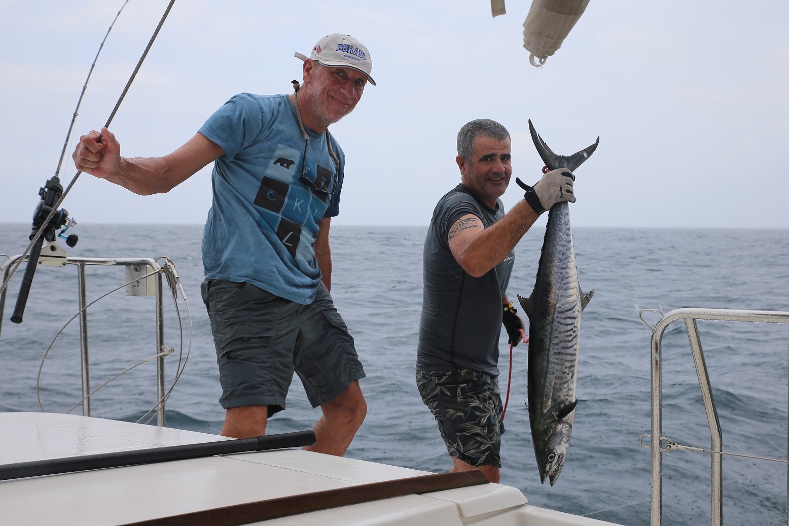
Anyway, after 5 days exploring Bali, the ladies joined us on Sophie and we motored 15 miles to spend the night at Lembongan, and island in the strait to the east of Bali. We were able to pick up a mooring and enjoyed watching the mostly Chinese day tourists being towed around on inflatable hot dogs, oftentimes right next to Sophie. But the daytrippers were all gone by 3:00 PM, and we then got a quiet harbor to ourselves. We were able to swim, paddle board, and eat line-caught yellowfin tuna for dinner.

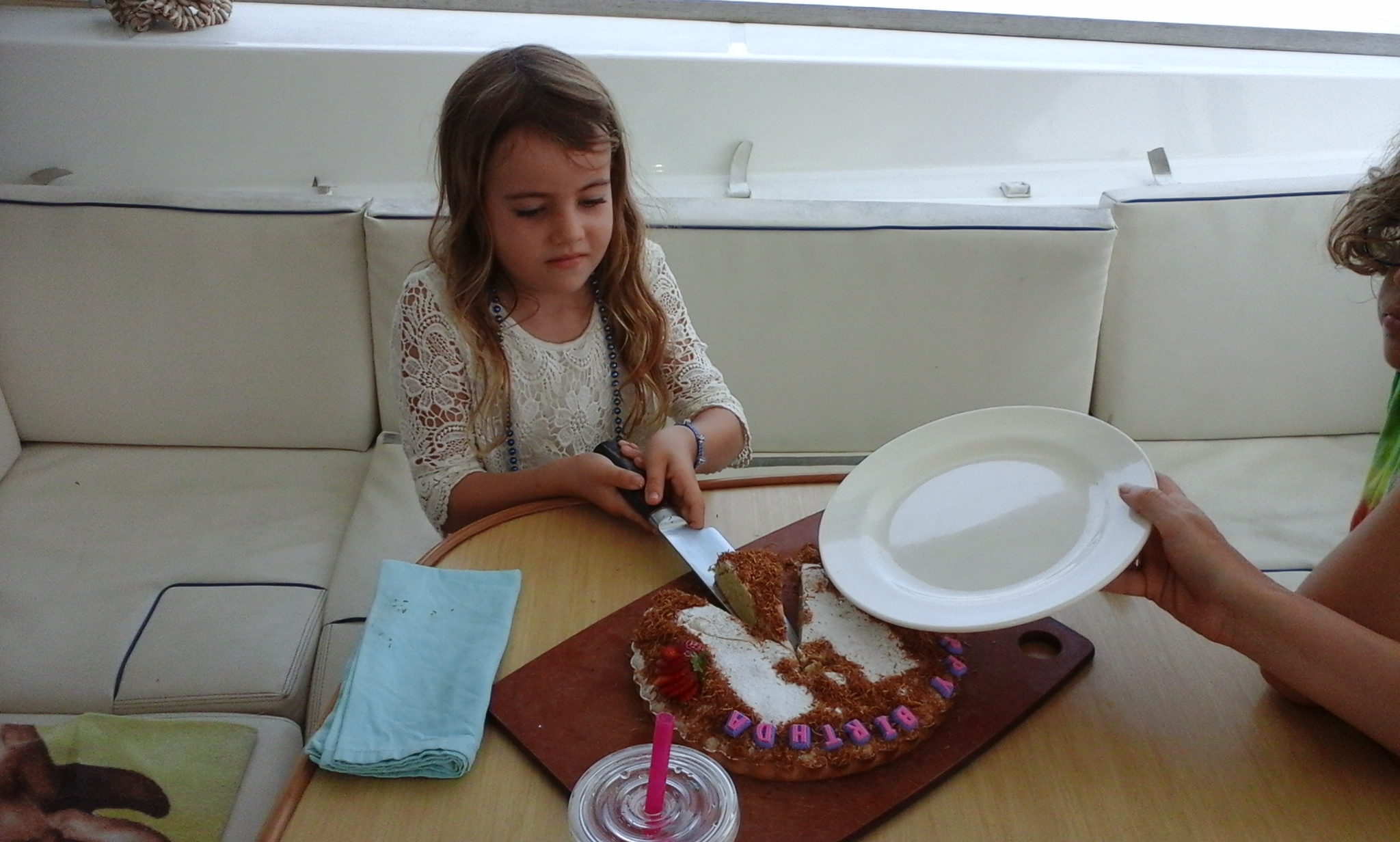
We returned to Serangan the next day and spent a long weekend celebrating HAZEL’S SEVENTH BIRTHDAY. The weekend involved three birthday dinners, an afternoon at a resort, and a return trip to the water park.

We held a birthday brunch on Saturday, where the Girls Week ladies, Guta and the Sophie crew enjoyed some homemade lemon cake, courtesy of Jenna.

h1

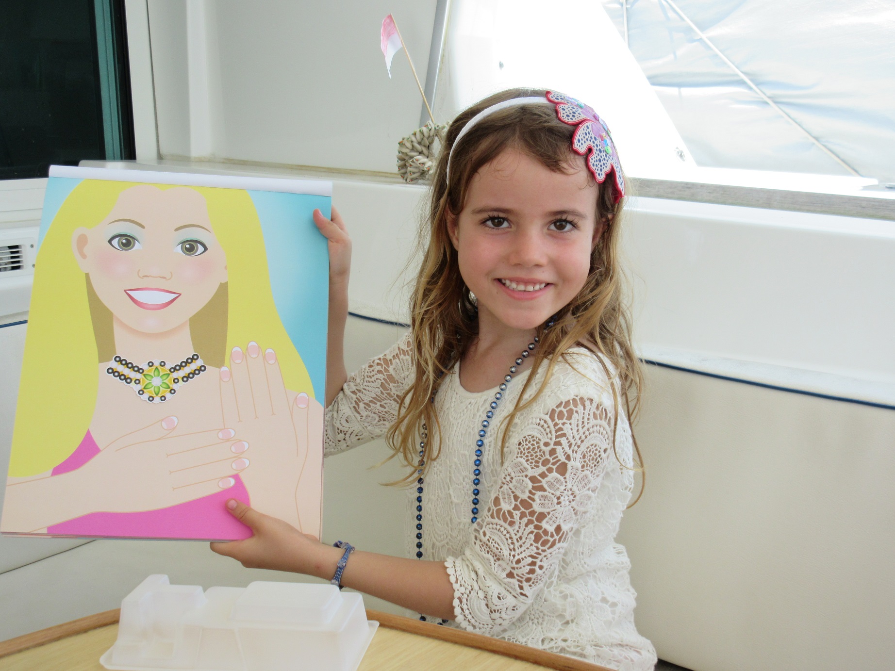
Hazel then enjoyed opening gifts from around the world, wearing her flower girl dress from her cousin Caroline’s wedding last summer.

h2

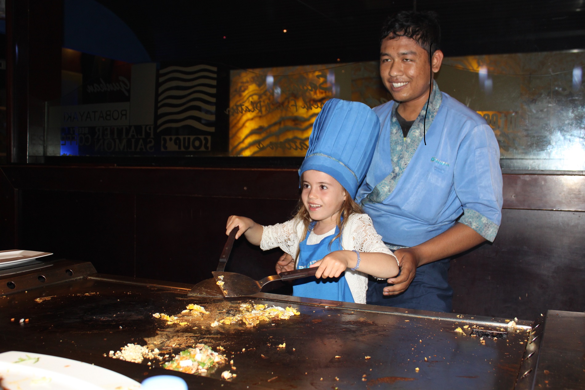
The festivities ended on Sunday night, when Hazel was invited behind the grill at a Japanese barbecue.

h25

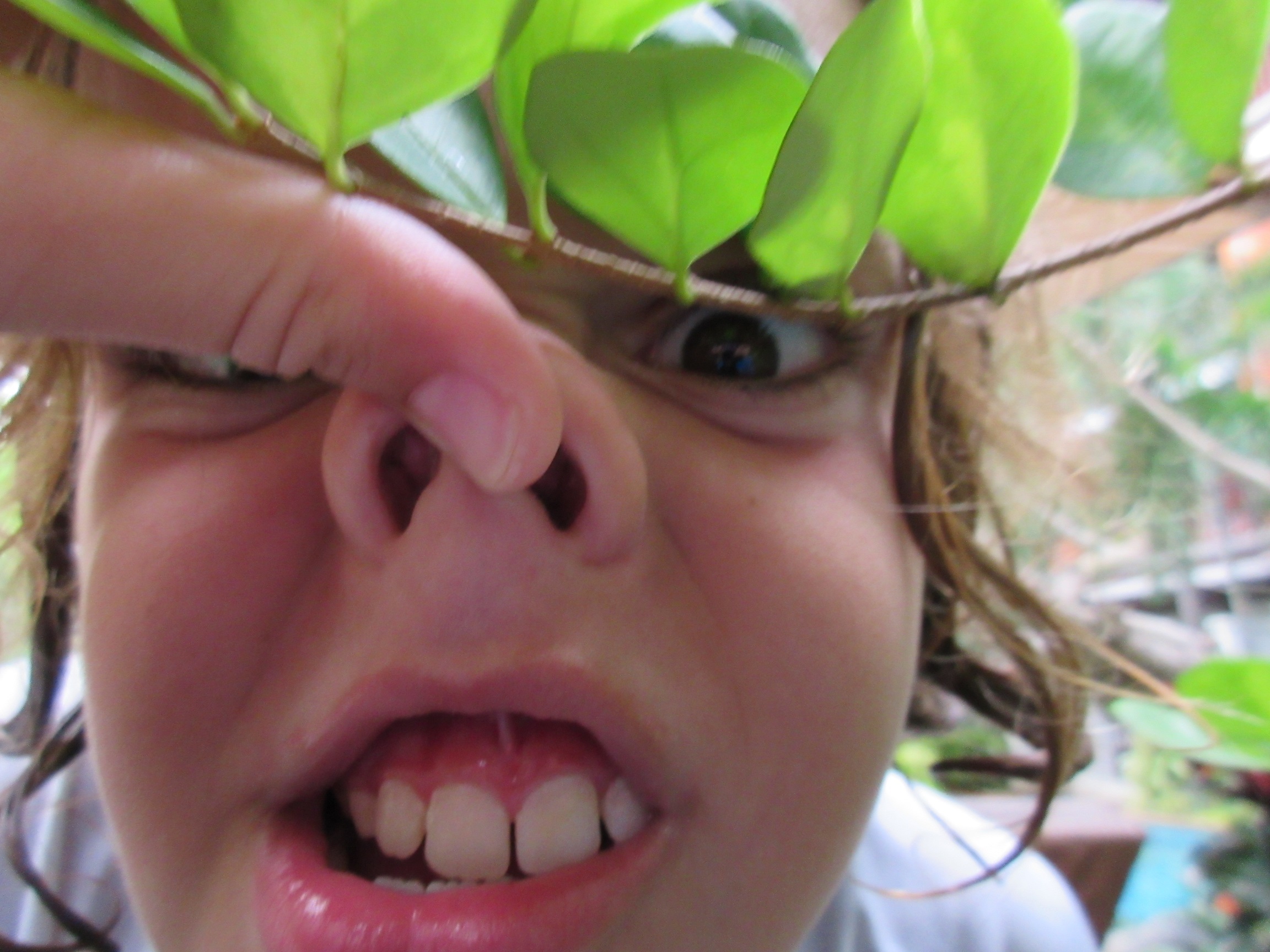
Jenna and I gave her a camera for her birthday, and like any kid she started out by taking some pretty goofy pictures.

h3

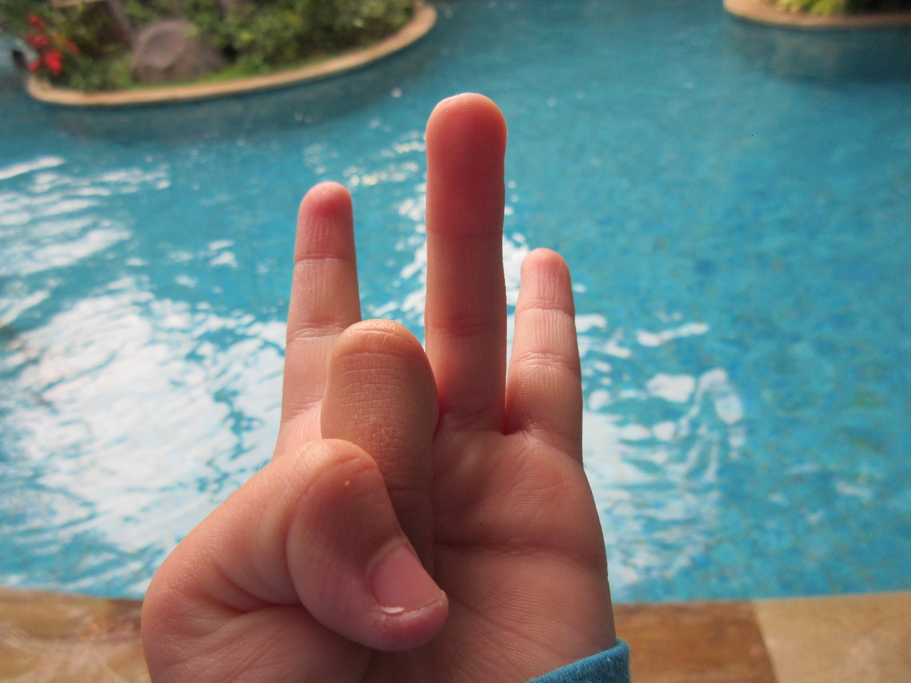
She also began to explore distance and perspective.

h6

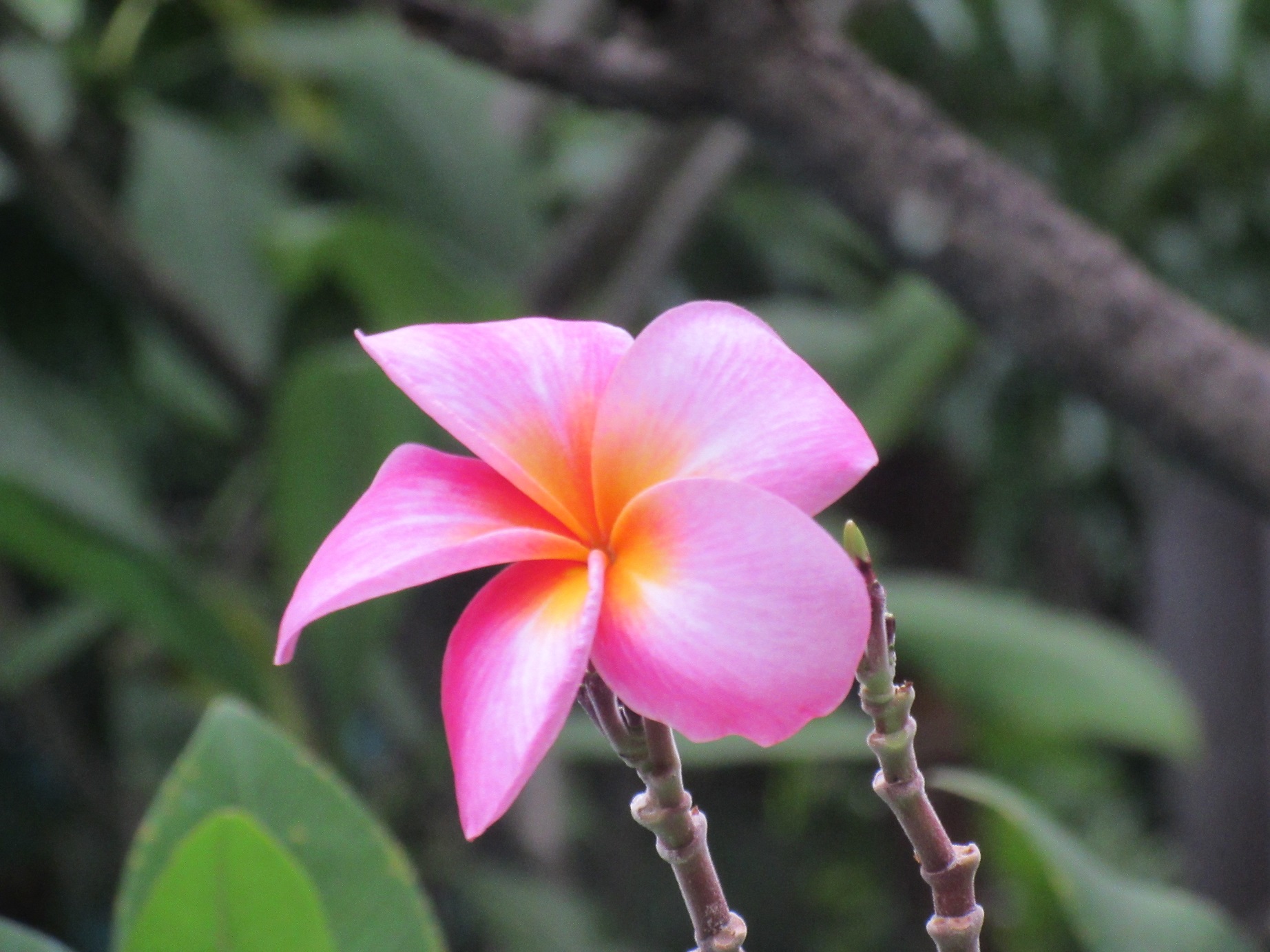
Before we knew it, she was framing some excellent photographs.

h4

She is obviously her mother’s daughter.

h5

The camera even has a button that automatically frames Leo in different perspectives. I think Hazel will be using this with great impact as we continue our trip.

h8

h7

We are all looking forward to the day when Hazel publishes her own blog post here, sharing her favorite photos with the world. Hopefully that will happen sooner rather than later.

Well, this post should give you a sense for what we’ve been up to for the last couple weeks. Our current thinking is that we will stay in Bali through March 18th for one last visa renewal, then head up to Kalimantan to hang out with the Orangutans before heading up to Singapore.

The luck keeps rolling, we keep learning new things, and we keep meeting new friends, in this case a dragonfly in Bali. She seems to like Sophie.

close


Hazel Won the Race!

I just heard from Jenna in Bali. Hazel saw a doctor last night. All of her tests came back negative. She’s fine and will enjoy a day relaxing by a hotel pool with her mother and second cousin. It’ll leave it to Jenna to post some photos.

Whew!


The Race to Labuan Bajo

IMG_4799Later that night after our first day on Sand Dollar Beach, I noticed that Hazel was burning hot when I started to carry her to bed after she fell asleep watching a movie. We checked her temperature, and it was 102.5 F. Earlier in the day she had complained of headaches and neck stiffness. All of this set off alarm bells for me and Jenna, because a quick search of the internet showed that these could be signs of meningitis.

So we did phone consultations with my daughter Sara (nurse practitioner in Boston) and Jenna’s sister Julie (pediatric resident at a children’s hospital in Philadelphia), and they both suggested we do some physical exams to test Hazel’s nervous system. She passed. So we gave her children’s ibuprofen and put her to bed.

The next morning Hazel’s fever was down to 100 degrees. She still felt soreness in her neck. Holly (DPT in physical therapy, works at Harborview Medical Center in Seattle) conducted one of those eye exams where Hazel had to follow Holly’s finger, and Holly noticed a flutter in Hazel’s eyes. We discussed this and decided that it made sense for us to get closer to a hospital. It was 10:00 in the morning, and our plan had been to slowly motor to Labuan Bajo overnight in order to conserve fuel.

That plan was quickly thrown out the window. We pulled the anchor and cranked both motors at 2600 RPM. We also had both sails up. The weather was hot and the seas were flat. It was like motoring in the Strait of Juan de Fuca in August except now we were on a mission. We were low on fuel, and if we ran out I was prepared to pull the boat up to shore, dinghy the girls in, and have them grab a car into town. We were also racing the sun.

INDO0413

It turned out there was no need for an emergency beach stop, because we covered the 80 miles to Labuan Bajo in 9 hours. We did blow past schools of large jumping tuna without stopping. This was serious business. We made it into town and anchored in the mooring field in the dark. Hazel spent the afternoon watching movies and eating mac and cheese. She was in good spirits and had lots of energy.

INDO0418This morning Hazel’s fever was gone and she remains in good spirits. We had to move the boat because it turns out we had anchored in a shipping lane. We are now anchored off a beach in front of a hotel.

Jenna and Holly were planning to head over to Bali tomorrow to spend a day there before Holly flies on to Seattle. Instead all 3 girls are heading over to Bali today. They have some excellent hospitals there, and Hazel has an appointment with a doctor this afternoon. They will then hang out in Bali, lounging by the pool and perhaps hitting a spa. We’ve heard that Bali can be fun for groups of girls who hang out there together. Hazel is quite excited to go off on a mini adventure.

INDO0434We are sharing this with all of you to keep you up to date on what is going on with us. Hazel is fine, but airplane tickets from here to Bali cost $60, so it makes sense for her to see a doctor. In the meantime, Leo and I are going to hang out on Sophie where we will clean the boat, do Sophie school, watch war movies, and drink beer.

I’ll let you know more as I know more. Lucky luck lucky.

Iceberg!

IMG_4780Last night during my shift I watched the movie “Titanic.” At one point in the film, the captain wrote down the coordinates for the location in the North Atlantic where the Titanic hit an iceberg. 41.46 N, 50.14 West. I entered that as a new waypoint into our chart plotter and saw that it is on a latitude south of Boston. It is also just 8700 miles from Sophie’s current position. Since we have already covered over 1200 miles since we arrived in Indonesia in November, the spot of Titanic’s sinking doesn’t seem that far away to me right now. We are currently thinking about crossing the North Atlantic in the summer of 2017. It would be really sad if we hit an iceberg. But that is a worry for another day.

IMG_4797The only ice we like to think about these days is the ice that goes into our passage enders, like the run and coke I enjoyed after we dropped an anchor at noon today in the Riung island group on the north coast of Flores, 250 miles and 50 hours from our starting point in Hoga.

We had no squalls over the last 24 hours, and the wind died out at sunset. We motored throughout the night directly towards our destination in order to give Holly a day of beach time. We wound up running both engines and cruised along at 7 knots through a glassy sea.

IMG_4777Flores greeted us this morning with a rosy sunrise and a string of active volcanoes. It was pretty cool. I did the 2:30 AM – noon shift to give everyone else the opportunity to sleep in and then have a productive morning of Sophie school.

Our morning was interrupted by a fish ball encounter. We saw some birds working a disturbance in the water, and as we got closer we saw a school of large tuna arcing into the air. Some of these were big fish, and they were jumping high. We already had a tuna lure and a Rapalo in the water, and I quickly added another big marlin squid which doubles as a teaser. We drove through the school multiple times, all with no luck. We soon learned why.

IMG_4789In the middle of the action was a line of dolphins lined up like armored knights on horseback in a Peter Jackson film, marauding through the tuna like they were a band of overmatched Orcs. Here are two of them, all business. The odds of those tuna hitting our lures were equivalent to the odds of my stopping for a pastrami sandwich while being chased down an alley by an armed gang. Or a line of armored knights on horseback. It just wasn’t going to happen.

IMG_4787The action did get everyone out of the cabin and into the sunshine. Holly and Jenna got some good photos. Everyone had fun.

IMG_4798Our anchorage in Riung is spectacular. We are nestled up against a small island surrounded with beaches, one of which Leo named “Sand Dollar Beach.” The rest of the crew paddleboarded in and explored the island while I enjoyed a post-shift nap.

We will spend two days here enjoying the serenity of Sand Dollar Beach and then motor the 80 miles overnight to the port of Labuan Bajo, where Holly will catch her flight back to the US. There is no wind forecast for the next few days, and I am pretty certain we won’t have to worry about icebergs. We have been pretty lucky in that department so far.

Moonlight Watches

Sophie left Hoga yesterday to continue on our passage from Ambon to Labuan Bajo on the western tip of Flores Island in Indonesia. We have a 10-12 knot westerly wind plus a slight current against us in the Flores Sea and covered 130 miles over our first 24 hours. It has been a relatively gentle passage so far. Holly and the kiddies took some Dramamine before we left, and no one has gotten seasick.

Our current position is 07.05.210S, 122.39.873E. We are heading due south at 5 knots. The wind is forecast to die down as we approach Flores, and when it does so we’ll hang a right and travel along the coast.

We left Hoga by heading around the top of Kepulauan Island and then sailing 14 miles southwest towards an unmarked pass in the Pulau-Pulau reef. Well, it turns out the Indonesian government has erected an enormous navigation marker on the southern end of the pass, right next to six fishing huts mounted on stilts over the reef. While there we were treated to dancing dolphins and then turned around to see a massive squall, complete with a waterspout, attacking the anchorage where we had been swimming just 90 minutes earlier. We certainly picked a good time to get out of Dodge.

We sailed almost the entire night with no motor under a full moon. It’s the first time we’ve done this in a long time, and it was beautiful. On two separate occasions Holly and Jenna spotted unlit fishing platforms the size of log cabins. They were both anchored in 5000 feet of water and lay directly in Sophie’s path. The girls were able to skillfully avoid collision each time. Thank goodness for the moonlight.

During my moonlight shift I unreefed the main and got Sophie up to 8 knots of speed a couple of times. I was smiling a lot. We seemed to have left the fishing area, so I watched the movie “Life Aquatic With Steve Zissou”, laughing at how much Bill Murray’s character reminded me of our friend Colin on the cat Segue. That was until the last 5 minutes of the movie, when it suddenly dawned on me that Steve Zissou was me, and that 11 and a half was my favorite age.

Jenna has become quite good at Indonesian cooking. Yesterday’s lunch was a stir-fried tempeh in a peanut sauce that melted in your mouth. Our meat/meal ratio is plummeting the longer we stay in this country.

It’s 115 miles to the “17 Island National Reserve” on the north coast of Flores, and our current plan is to drop a hook there on Saturday morning and spend a day relaxing and snorkeling. From there it’s just 70 miles along the coast to Labuan Bajo and another 15 miles to Komodo, home of the dragons. We are going to need a little more luck in the wind and tide department, but we would love to get a photo of Holly posing with some dragons to cap off her vacation with us. That would be awesome.

Holly in Hoga

 20150204_150143

We arrived in Hoga safe and sound two days ago. Our passage from Ambon wound up being a gentle and safe passage after our initial squall coming out of Ambon.

As I mentioned in our last post, Jenna’s cousin Holly has joined us for the passage from Ambon to Flores Island, and we are giving her the complete Sophie Adventure Cruise experience during our stopover in Hoga.

INDO0285

We arranged for a dolphin show…

INDO0311

… and a sunset-lit thunder boomer …

INDO0324

… followed by a rainbow …

INDO0325

.. and capped of with an eggplant parmesan that Hazel and I prepared in Holly’s honor.

We are currently anchored in a passage between the islands of Hoga and Kepulauan. In reading the description of Hoga published in the book “101 Indonesian Anchorages,” we thought it would be a remote and wild nature reserve. It turns out that Hoga is indeed part of the the area’s Wakatobi Marine Reserve, but it has a village and a dive resort. Across the bay in Kepulauan are multiple large villages complete with stores and cell phone towers.

We’ve spent two nights here and have fully recovered from our trip from Ambon. Activities here have included swimming, snorkeling, poker (Leo has learned a new game!), and Settlers of Catan.

The weather looks pretty settled over the next 4 days, and we will depart in a few hours for the 280 mile passage southeast to Flores and Komodo Islands. I’ve been worried about this passage over the last month because I’ve seen nothing but 20-30 knot westerly winds in the Flores Sea weather reports since Christmas. Our current forecast is for 10-12 knot westerlies today, dying down to under 5 knots over the weekend. The local dive master says that in March, the wind transitions around from northwesterlies to the southeast monsoon. Based on the forecasts we are seeing, I believe that this transition period has begun. This is great news for us, because it means Sophie will soon begin sailing downwind as we continue on our journey to Bali, Kalimintan, and Singapore.

That’s about it for now. Holly and Hazel are making crepes. I assume they will be delicious.

On to Hoga

I took a break from writing the blog over the last 10 days while I was in the US for my annual cancer screens. Great news all around. I am still cancer free, I had the opportunity to visit with good friends back in Seattle, Jenna’s cousin Holly flew back to Indonesia with me for a 12 day Sophie Adventure Cruise, and we decided to depart Ambon for Hoga Island in the Wakatobi Group the morning after Holly and I arrived back on Sophie.

Oh yeah, and we also just learned that our beloved New England Patriots won the Super Bowl over the Seattle Seahawks in a nail biter of a game. Go PATS!, and thank you Seattle fans for all of the love and respect you showed me and my Patriots hat over the last week.

We didn’t watch the game because we had a good weather window for a Sunday morning (local time) departure for our 300 mile run from Ambon to Hoga. There are prevailing westerlies in Indonesia this time of year, and we have committed to friends that we will travel 800 miles to the west and into the wind from Ambon to Bali within the next three weeks. Our strategy is to first cover the initial 300 miles in a hop over to Hoga, then cover another 300 miles southeast to Flores Island, then skim along the coast of Komodo, Sumbawa, and Lombok in order to get to Bali. After we explore Bali for a bit, we will probably cruise back around these 4 islands for a couple of months as we wait for the local weather to transition to monsoons from the southeast, then we will sail with the wind up to Kalimintan to visit some orangutans and then head on to Singapore, Malaysia, and Thailand

So this initial Hoga leg was pretty important to us, important enough to make us decide to skip what turned out to be an awesome Super Bowl. The weather forecast called for 5-15 knot westerly winds from Sunday to Monday night, increasing to 10-20 knots Tuesday through Friday. We now know that in this part of Indonesia, the wind speed can easily be double what is forecasted, and Jenna and I were not thrilled at the idea of motorsailing into 30 knots of apparent wind for 300 miles just so that we could watch the Super Bowl. So it was an easy decision to take off on Sunday morning.

It was tough, however, to say goodbye to our friends in Ambon. We have sailed with the Kee family and their boat Per Ardua for 3 months and 2500 miles, but their boat simply cannot motor to weather the way that Sophie can, so they will be heading Southeast to Banda and will hopefully rejoin us in Malaysia in June. Spending an extended amount of time with the Kee family was everything we had thought and dreamed cruising in the tropics would be like. We are all going to miss them very, very much. The same goes for John and Sue on the catamaran Ocelot, who will be heading to Banda with Per Ardua. Finally, while in Ambon we were able to connect with the Moores and the Connors, two lovely American expat families who shared with us incredible kindness and hospitality while helping us navigate around town. They were an especially big help to Jenna and the kids while I was back eating cheeseburgers in the US. We hope they can come and visit with us as we continue to head west.

Sophie pulled anchor in Ambon at 10:00 AM local time on Sunday and enjoyed a fast motorsail for the first 20 miles out of Ambon Bay. Then the seas turned into a bit of a current-induced washing machine, and Holly became seasick. Then we were hit by one of our biggest squalls on the trip, a 15 mile-wide monster with sustained winds of 20-35 knots for 2 hours. It blew out by 8:00 PM, but it took the seas several hours longer to calm down. We’ve been motoring into a 10 knot headwind and 1 knot current for the last 15 hours. Both engines are running @2100 RPMs, no sails are up, and we have been averaging 6 knots since we left Amobon. We had a beautiful moon throughout the entire night and today has been bright and sunny with no rain. The current keeps the seas flat, and Sophie has a gentle motion. It’s great to be back where I belong.

Our noontime position was 04.37.22 South 124.38.46 East. We covered 160 miles in 26 hours after leaving Ambon, and at this speed we will drop an anchor in the lagoon at Hoga on Tuesday morning. There is supposed to be excellent coral and beaches there, and we are all looking forward to getting back into the water.

We are so lucky to be doing this, and we look forward to watching a DVD of the game in a couple of weeks.

Anchorages in Raja Ampat

cover
We spent 7 wonderful weeks in Raja Ampat. It is an ocean paradise that is off the beaten path typically taken by cruising boats moving beyond the Pacific. We’ve been told that only 20 boats a year visit this area!
Jenna and I found it hard to find information on anchorages in Raja Ampat, so we decided to pull together a blog post that documents where we stayed over the last 2 months. We hope to help our friends following us down this path in the years to come. We also want to thank Brick House, Totem, Nalukai, Ocelot, and everyone else who shared information with us. We couldn’t have done this trip without your help.
Sorong
Sorong
Sorong is not pretty, but it has excellent wifi and good provisioning at the Saga Supermarket. Victor Sapura (victor.s@intracodharma.com) is your man here and can help with diesel, propane, beer, and locating parts. We anchored at 00.53.172S, 131.15.600E in 70 feet of mud and plastic. This is near where the liveaboards (local dive boats for tourists) anchor and is close to the pier that the fishermen use. You can leave your dinghy at the pier when you head into town, but it is best to do so after 10:00 AM. The local fishing fleet brings their catch in during the early morning and the pier becomes quite crowded.
Yangello
Yangello

This is a very sheltered spot in the mangroves on a little channel between Yangello Island and the southwest tip of Gam. The channel itself is deep and navigable. We tied up at 00.30.722S, 130.27.315E using multiple long lines off our bow and stern. Excellent snorkeling along the channel, and the green water snorkeling in the mangroves is a unique experience. Around the corner is a small beach with a beach hut where kids can play and where grownups can make a beach fire. Excellent spot where we spent several nights.
Pef
Pef
This is a small island 5 miles north of Yangello and is owned by the Raja4Divers resort. The Navionics chart shows Pef as being a single round island, but there is actually a deep lagoon in the middle of the island, and this lagoon has 2 moorings maintained by the resort.  The moorings are at 00.26.556S, 130.26.625E, and a good waypoint for making your turn into the lagoon is 00.26.822S, 130.27.006E. The resort charges ~$20 US per adult for using the mooring, but in return encourage you to use their facilities (wifi, laundry, snacks, happy hour with complimentary beer.) We were short of cash (very few working ATMs in the area) and spent 3 nights there in return for taking the resort’s guests and staff out on a sunset sail. The kids enjoyed swimming in the lagoon until we saw the crocodile that was caught nearby. Jenna and Mellia had one of their best paddleboards ever, navigating the spectacular gumdrop islands in the lagoon. It was a great stop, and the people at the resort were quite friendly to cruisers.
Wayag
Waya
This island is a nature reserve on the northwest corner of Raja Ampat. We spent a week here. It has it all: mountains, gumdrop limestone islands, beaches, protection, coral, and no people. We spent 5 nights anchored off a beach in 50 feet of sand at 00.09.738N, 130.01.954E. We spent our last night on a mooring ball at 00.09.827N, 130.01.485E. The photo Jenna posted to the blog on Christmas shows Sophie on this mooring and was taken at the summit of a mountain hike with a trail maintained by the local park service. This place is a must visit for anyone coming to Raja Ampat. Like Pef, the Navionics charts for the area fail to show the giant lagoon in the middle of Wayag. Some useful waypoints for navigating into the lagoon are 00.10.150N, 130.00.738E; 00.10.238N, 130.01.197E; 00.10.164N, 130.01.352E: and 00.10.139N, 130.01.455E. There are 2 mooring balls maintained on the island. The first one is visible as you follow this track into the anchorage, and the second one (the one where we spent a night) is off to starboard in its own little bay as you follow the route in.
Friwin
Friwin
We spent multiple nights anchored off Friwin at 00.28.142S, 130.41.645E. There is a current here, but there is good holding and some excellent snorkeling around Firwin itself and around some little rocks to the north. There is also a strong mobile data signal here. Great spot.
Waisai
waisaiWe never spent the night at Waisai, but stopped here multiple times to provision and collect passengers. It is a new town being built by the government to support the tourist industry in Raja Ampat and is NOT the Waisai that appears on the Navionics chart. This Waisai is spread out over 3 bays along the southwest coast of Waiego. The western bay (00.25.982S, 130.48.075E) contains the ferry terminal and little else. There is no ATM and no provisioning. There is a floating dock where you can tie up a dinghy on the east end of the bay. It is linked to the ferry terminal by a 300 meter long covered pier. Make sure you follow the channel markers as you head into this floating dock! The ferry terminal itself is a concrete pier. I was able to pick up a guest and his luggage/supplies cache there, but it was a little hectic. The middle bay of Waisai (00.25.831S, 13.49.422E) is where we anchored when we stopped there. It’s the location of the town and is on the mouth of a river. Be careful of the river bar at low tide. We tied the dinghy up at a concrete pier with black and yellow stripes located at the mouth of the river on the left hand side. Next to this pier is a shack that will sell gasoline and diesel. Then there are 4 blocks of small shops selling hardware and dry groceries. There is an ATM that worked once and didn’t work once. The biggest store is located in the Raja Ampat Hotel. They had bread along with frozen beef and chicken. Waisai’s eastern bay is where the public market is located. I don’t have a waypoint but it was a 4 minute dinghy ride from our anchorage off the main town. You can see a line of blue-roofed buildings behind the mangroves on the left side of bay, and there is a small wooden pier where you can tie your dinghy. Look out for the shallow coral approach at low tide. The produce in the market is excellent, better than what we saw in Sorong. The also have eggs but no bread. No ATM. But great provisioning.
“Christmas Bay”
Christmas BayAfter Waisai, we joined 6 other boats for Christmas in the big bay that opens up on the southern side of Gam. I believe it is called Besir. We now call it Christmas. Our anchorage was at 00.30.444S, 130.33.690E in 60 feet of water. We entered the harbor via the easternmost entrance. Be careful to head a good way into the bay before turning towards the anchorage in order to avoid a reef that extends northeast from one of the islands. This anchorage was selected because it was large enough to hold a small holiday fleet. There was no beach or coral nearby, but there was great swimming among the boats. There was also good paddleboarding and kayaking around the islands at the mouth of the bay. I saw some LARGE fish there while snorkeling along the abandoned pier on the west side of one of these islands.
Kabui Pass
IMG_0053
This excellent anchorage is located at 00.25.380S, 130.34.218E at the eastern mouth of the narrow channel that separates Gam from Waiego. We approached from the northeast and anchored among some gumdrop islands in 60 feet of water. The pass offers excellent drift snorkeling that is best done near slack tide to avoid strong currents. Beautiful spot.
Eastern Batanta
We spent a night in this unnamed anchorage as a convenient stopover between Waisai and Sorong. 00.46.485S, 130.53.301E. It was surrounded by mangroves and seemed to collect garbage carried by the currents flowing out from Sorong. Not a pleasant spot but it helped us cut a long passage into two shorter ones.
Teleme
river
This is an excellent stopover on the Selat Sele for boats heading south from Sorong on their way to Misool. There was a strong south setting current in the channel and a 10 knot opposing southwesterly breeze, so we motored up to 01.22.911S, 130.59.864E to avoid the breeze. The entire channel was deep, and the anchor set quickly in the mud. Nice stop.
Mustika
gunshot
We anchored in this exposed area off the east coast of Misool for 2 nights in order to celebrate a birthday for one of the Per Ardua kids without being underway. 01.53.472S, 130.26.905E. I think it offers more protection in the southeast monsoon than in the northerlies we were getting. We felt we were dragging most of the time and had to set our anchor twice. At one point I was swept away by the current while attempting to swim the 20 meters between Per Ardua and Sophie. Peter tried to rescue me in their inflatable kayak but the current was too strong. Jenna had to lower the dinghy in order to retrieve me and get me baclk onto Sophie. Don’t go here.
But DO put your trolling lines out after you depart Teleme. Maybe you, too, can pose for some gunshots.
Balbulol
balbulol
GO HERE INSTEAD! This anchorage ranks right up there with Wayag as our best stop in Raja Ampat. We stayed here for a week with 2 other boats, spending 3-5 hours a day snorkeling the coral walls. Our best drift snorkeling ever. It’s a small protected lagoon with limestone cliffs that ascend 30-100 meters into the air. These cliffs descend another 30 meters underwater. We used long lines to tie bow and stern to opposite cliffs. 02.01.494S, 130.40.427E. Tens of thousands of fish. Spectacular coral. A very large poisonous snake! A scorpion fish! Glow-in-the-dark jellyfish! Completely protected. No town, but there was a small fishing camp on a beach around the corner. The fishermen pretty much left us alone. We could have stayed here forever.
Misool Eco Resort
As I mentioned in our last post, Per Ardua’s mooring line separated 2 hours after they stopped here. Several other moorings have failed here in the last few months. We spent a nervous night on the resort’s last remaining mooring at 02.14.791S, 130.33.478E.  Other cruisers had a good experience here, and there apparently are some deep anchorages nearby. The people at the resort were quite friendly, but we can’t recommend stopping here until they fix their moorings.
So that’s it.13 stops from November through January. Some of the best cruising of our lives. Can’t you just tell how happy we all are?
ladies

Goodbye, Raja Ampat. We will miss you.

Sophie has slipped the mooring cable at the Misool Eco Resort and has begun a 200 mile sail that will get us to the western side of Ambon Island. Currently motorsailing at 7 knots at the location of 02.15.550S 130.25.336E. We’ve spent the last 6 weeks in Raja Ampat, and it has been a highlight of our entire cruising adventure. We will miss this special place a lot.

We left the anchorage at Balbulol yesterday morning. We spent a week there and loved every minute of it. We snorkeled the coral walls for 3-5 hours every day. Jenna took 5,000 pictures with her GoPro. She even tied it to a 10 foot long string and lowered it down for coral and fish close ups. We saw tens of thousands of fish and an amazing variety of coral. We even saw what turns out to be the world’s most deadly sea snake. It’s 5 feet long, 2 inches thick and has black and white stripes on top and a white belly below. I first stumbled across her while snorkeling for lobster. She was in a little cave, and when she saw me she slowly got into a cobra pose and looked poised to strike. My fear was making me want to swim away, but my utter fascination was drawing me in closer.

I now understand snakes.

We experienced a couple of hiccups while tied to the walls in Balbulol. Our genset overheated and then stopped. It turns out we had sucked a couple of plastic bags into the raw water strainer, and this blockage caused the genset impeller to lose all 13 of its blades. When we disassembled the genset’s heat exchanger, we discovered 25 impeller blades there. Obviously the tropical ambience of the lagoon put the impeller blades into the right mood, and they multiplied as a result.

I also got a bit of a leg infection when I scraped against some coral while hunting lobster. I never actually caught any of the little suckers, because they scoot way back into their holes when you try to grab them. But my leg hurts a lot, and my daughter Sara-the-nurse-practitioner has put me on a couple of antibiotics. I’ll be fine.

The three boats left Balbulol at first light yesterday, with Sophie and Per Ardua heading 15 miles south for the Misool Eco Resort. We caught the world’s smallest mahi mahi on the way. It was only a foot and a half long, and he swam away vigorously when we released him.

The Misool Eco Resort has a good reputation with cruising boats who have visited there, but we had a terrible experience yesterday. The staff was quite friendly, and the facilities looked great. Steve snorkeled the wall and saw some huge fish. They even let us use their incredibly slow wifi for free and let the girls play on their beach.

Our problem was with their mooring lines. Sophie and Per Ardua were both moored in a little pass with a bit of a current directly in front of their pier. Per Ardua’s mooring line … dissolved and separated 3 hours after they tied on to it. Fortunately I was at the bar with Steve and Mellia watching the girls play on the beach when I noticed Per Ardua drifting close to their dinghy dock. Peter was on board, and I called him on the VHF. He came up on deck and realized the boat was simply drifting in the eddies of a passage with reefs and cliffs 20 meters away on either side of him.

They could have lost their boat.

Fortunately it was 4:00 in the afternoon and Peter quickly got his engine on and the boat under control. Sue, the resort manager, was very nice and said there was another mooring a mile away at Kalig Island, but Steve and I went over in our dinghy and could only find some wall ties. Perhaps that is what they meant. The resort’s mooring up on Yilliet Island, which our friends have used in the past, broke a month ago. The resort also had another mooring around the corner on Batbitiem Island, but that appears to be gone as well.

So Per Ardua decided on the spot that their best option was to leave for an overnight sail heading upwind for a sheltered anchorage on the west side of Misool. Since the sun was setting, they really had no other choice.

Sophie was on the mooring that their provisioning ship uses, and after Per Ardua left I dived the line as far down as I could. I couldn’t see the mooring block — we are in 25 meters of water — but the line was 1.5 inch nylon and looked new.

Nevertheless, we were in a bit of a rolly channel, and at times Sophie’s transom was only 20 meters from a cliff. Dinner last night was a quick bowl of pasta, followed by the movie Battleship (which was an excellent choice given our predicament … think board game + aliens + Rihanna with machine guns) followed by an uneasy night with the anchor alarm on.

The Misool Eco Resort seems like a nice place, but if they want cruising boats to use their moorings, they need to regularly dive them and inspect them. Most of us would be happy to pay a mooring fee.

And we won’t let the events of the last 20 hours shape our view of Raja Ampat. Best place ever. On to Ambon.