Sophie’s Circumnavigation on Google Earth

After our family returned to Seattle this past summer, Jenna and I put together a tool that maps out the route of our entire circumnavigation on Google Earth. It turns out that this is a great visual aid in presentations we give to local groups. It is very cool.

To build this, we created a project in Google Earth and entered in all of the waypoints from our entire nine-year circumnavigation. Each year of sailing is represented by a different colored line. As you rotate the planet, you can see the route we have sailed for each year of our adventure cruise.

You can literally scroll the globe and “see” where we traveled. For example, the picture above shows our 2015 route, where we sailed from the Raja Ampat region of Indonesia to Phuket, Thailand. This was one of my favorite years of the passage and included stops in Komodo, Bali, and Singapore.

In most locations, you can use the tool to zoom in and see the actual harbors where we stopped. Here is a screenshot of where we stayed in Venice. The red line shows our track in and out of the inner harbor.

Zoom in some more, and you can see the Marina Santelena in Venice and the actual DOCK where we stayed. By the way, this marina was a spectacular location, just a 5 minute walk to the Biennale and the Piazza San Marco.

Anyway, I have no idea if this will work, but here is a link to the Sophie Circumnavigation Google Earth Project. Click here to access the web page. Once you are there, click the Present button and off you go! Please leave me a note in the blog comments if you have any questions or feedback.

Sailing Across Greece

Quote

GREC5389
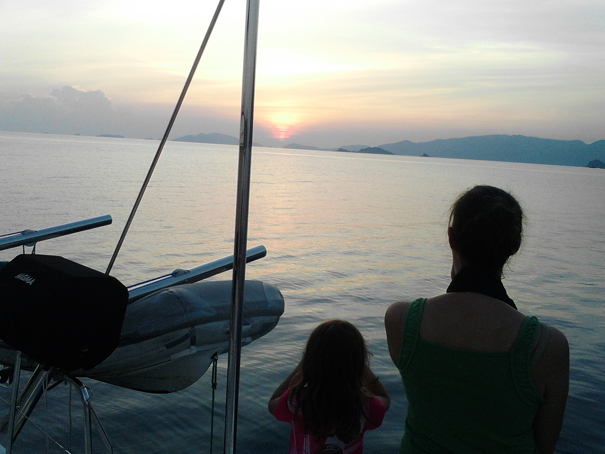
Sophie has been anchored in front of my brother David and his wife Goga’s house in Kotor, Montenegro for the last week. Our current location is 42°27′.934N, 18°45′.704E, which places us at the same approximate latitude as the Rogue River in Oregon (for those of you keeping track at home.) Our arrival here is one of the happiest accomplishments of our sailing adventure, one of the reasons we decided a year ago to come to the Med via the Indian Ocean and the Red Sea. We are in a good place.

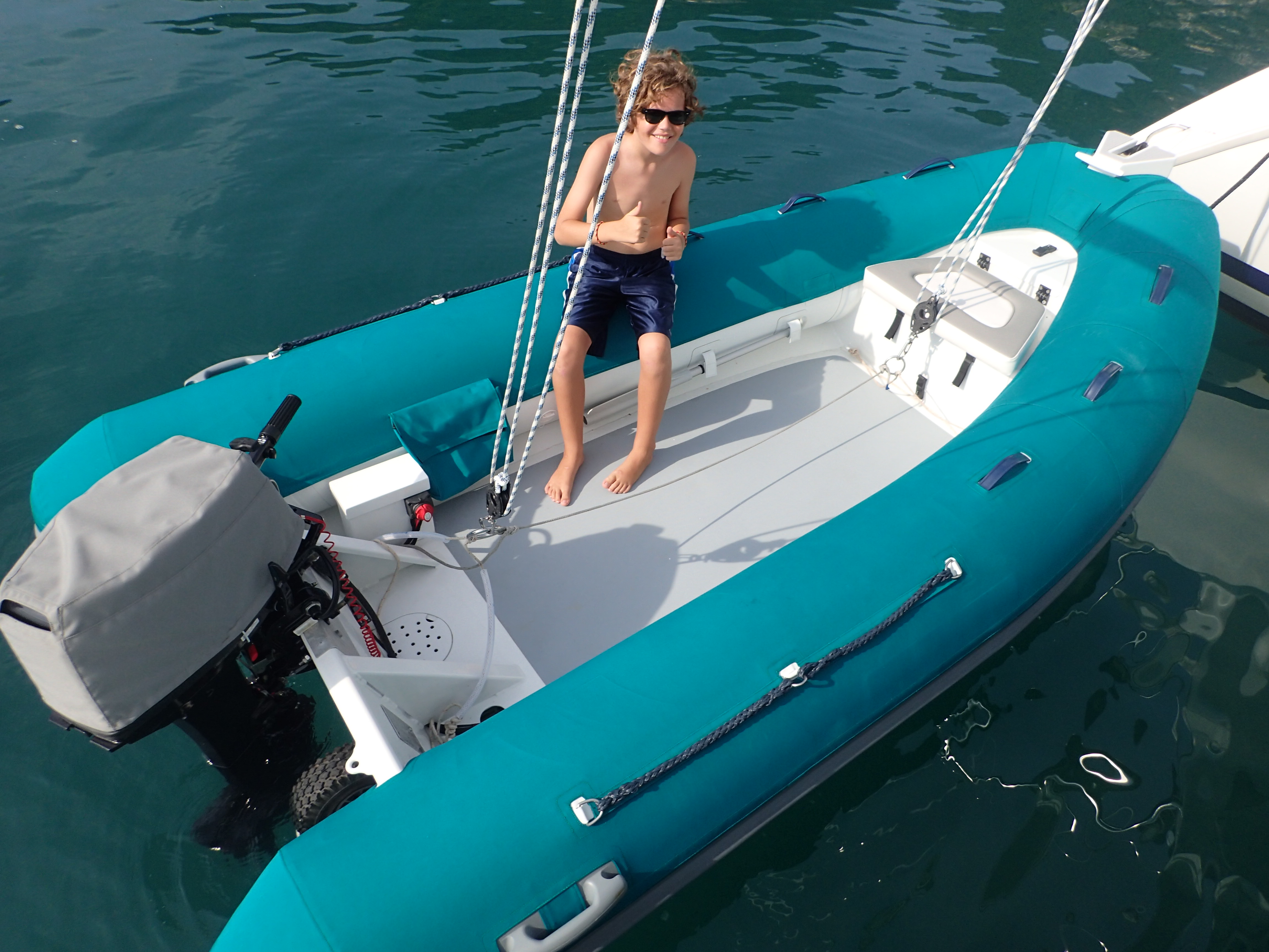
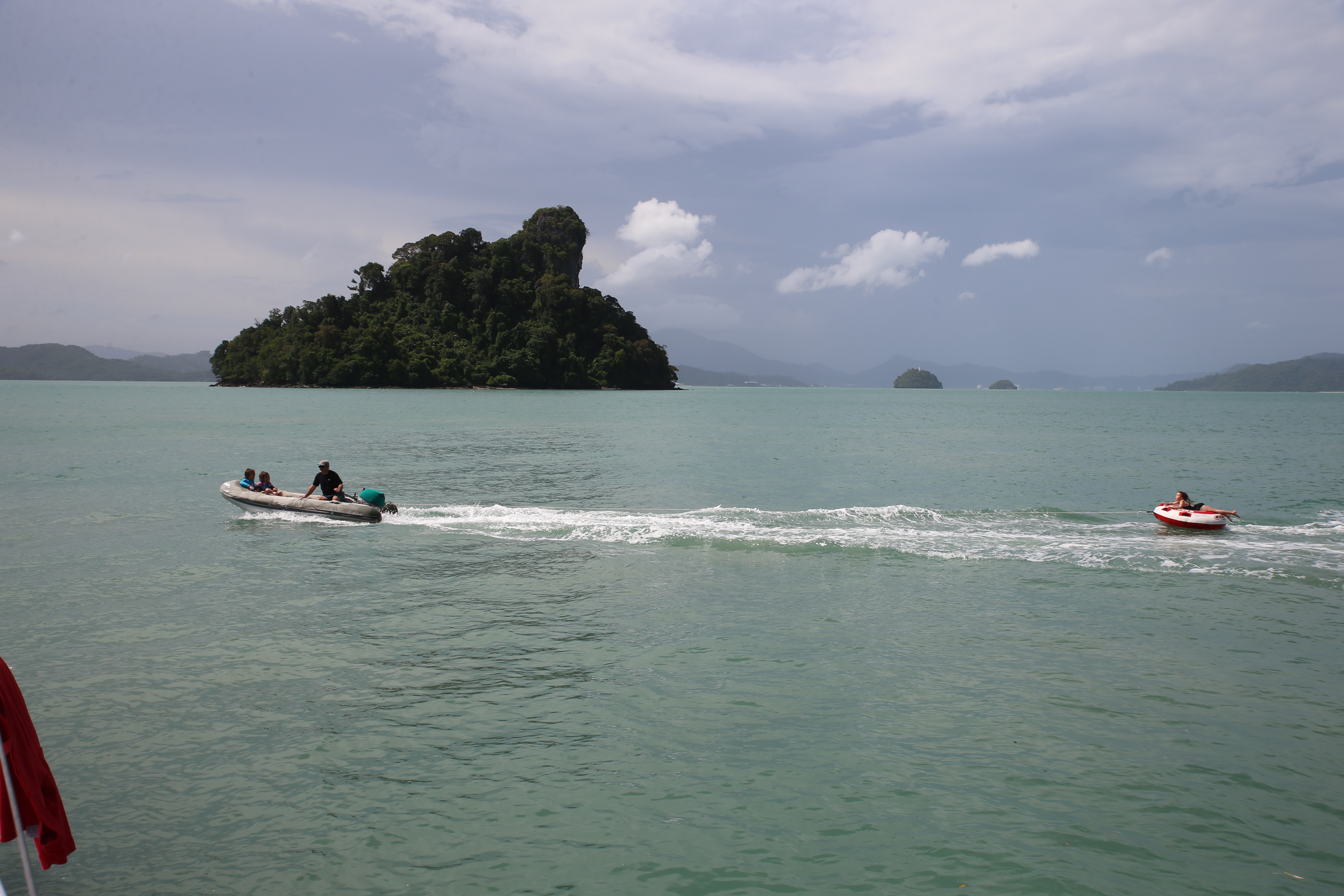
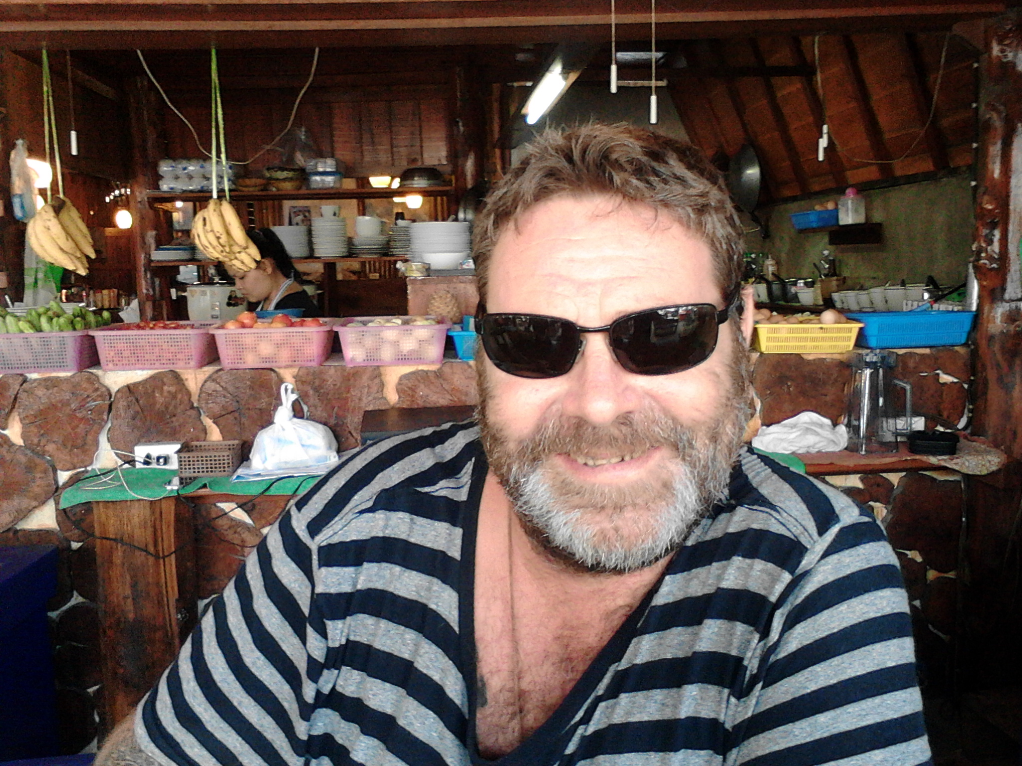
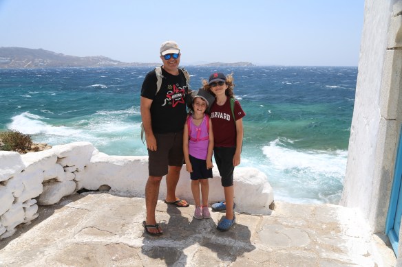
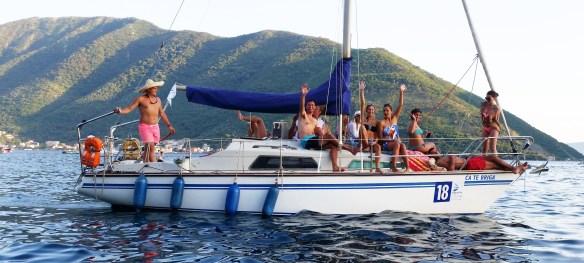
In order to get to Montenegro from Turkey, we spent 6 weeks sailing 500 miles across Greece. It was a spectacular experience which we were lucky to share with our friends Randy and Susan (joining us in the photo above.) If we weren’t on a schedule to meet up with family, we could have easily spent months or even years in Greece.

We could write 30 blog posts and post 1,000 photos and still not entirely capture the full extent of our experience in this country. This blog post is my initial attempt and focuses on the harbors and anchorages we visited during our passage. Jenna will be following up with her beautiful photos, as usual.

rhodes

Rhodes
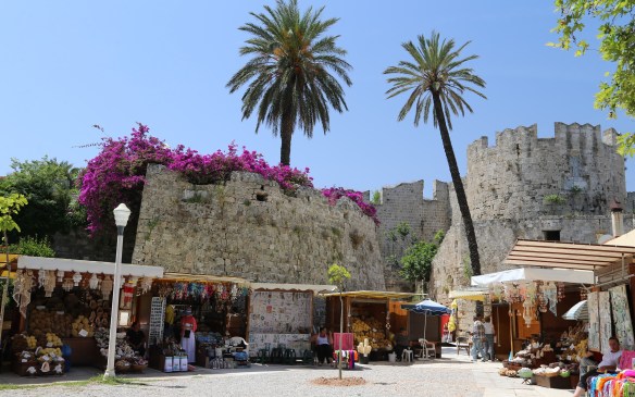
We cleared out of Turkey in Marmaris and made the 25 mile passage to Rhodes in half a day. We were able to secure one of the last available berths in the Mandraki Harbor in the port of Rhodes, but it took us 45 minutes to med-moor on the quay due to the 25 knot cross-breeze. It was not fun, but we later learned that 2 other bats had tried to moor in that same spot and gave up. That made us feel a little better. Our berth was at 36°27′.054N, 28°13′.600E. After securing the boat, our entire family made the pilgrimage to the Port Police, Customs, Immigration, and then back to the Port Police. We stopped for our anniversary dinner at our first outdoor Greek taverna in the middle of this process. and eventually everything sorted itself out. We were finally in the EU! The Port of Rhodes is centered around an old town and fort that was built by the Knights of Saint John during the Crusades. The museum is excellent, as is the ancient Greek stadium and amphitheater. Unfortunately, the Colossus of Rhodes is long-gone.

tilos

Tilos
After Rhodes we went to Tilos for an overnight stopover. We anchored on the south side of the island at 36°25′.753N, 27°20′.894E in 30 feet of water. On the way to Tilos, we caught an actual tuna fish, proving once and for all the the Med is not completely fished out. The anchorage provides good shelter from the prevailing northerly meltemi wind, but we woke up to a southerly and exited the harbor at first light.

asta

Astapálaia
Our next stop was Astipálaia, an island off the beaten tourist track that had a reputation in the middle ages for being a haven for pirates and smugglers who hid their boats in Astipálaia’s many coves. We anchored in a little harbor by ourselves in the middle of the south coast at 36°34′.416N, 26°23′.234E in 25 feet of water. I brought my bike to shore and struggled over the little mountain range to visit the main town of Skala. Later we all had dinner in our anchorage at a cute taverna with brightly colored chairs and an interesting mural of a pirate wench sporting an ouzo-firing submachine gun.

20160603_184552

Jenna just sat there, shaking her head. It was a very quiet and relaxing island to visit. We stayed two nights.

GREC5373

Santorini
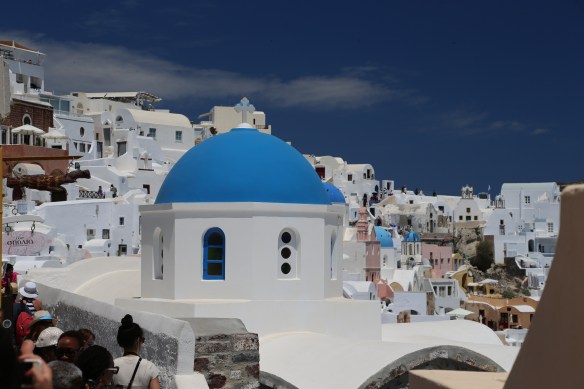
This is the famous Greek tourist island with the iconic blue-domed, white painted houses perched on the cliffs of a massive ancient volcano. Even though Santorini is 10 miles long and is visited by four cruise ships a day, it only has one small harbor, Vlikhada, located at its southern tip. Fortunately we were able to cajole our way into a berth there and used it as our base in Santorini for a week. 36°19′.997N, 25°26′.136E. The anchorage is very small and very shallow; upon our exit we wrapped a mooring chain around one of our propellers as we navigated the channel in 6 feet of water. Oh my goodness, Santorini was a special place! Our friends Randy and Susan flew in from Seattle and joined us here for the start of their 2 week Sophie Adventure Cruise. We toured the island in a rental car for a couple of days. We did the famous walk along the cliffs from Thira to Finikia. We visited the preserved ruins of one of the oldest archaeological sites of pre-Hellenic Greece. We toured a wine museum with underground animatronic displays of 19th century wine making. We ate great food, drank good wine, and even discovered a bakery with an outdoor, self-service kegerator. Birthplace of civilization, indeed!

20160604_205823

My personal favorite was sitting in a taverna above the Vlikhados harbor at sunset and watching the ballet of 25 charter catamarans all coming in to a narrow, 200 meter-wide harbor after sunset. It was quite a show!

fole

Folégandros
After the hustle and bustle of Santorini, it was nice to sail over to Folégandros, a quiet island with a chora (Greek town) on a cliff overlooking a broad expanse of sea. We anchored in the main harbor and hiked up the road to have dinner and watch Eurocup football in the town. At one point I even rented a quad 4×4 to make it easier for a hungry, post-school Hazel to make it up the hill to dinner. This was a great spot. We anchored at 36°36′.791N, 24°57′.050E in 12 feet of water.

IMG_1954 [22016]

Milos
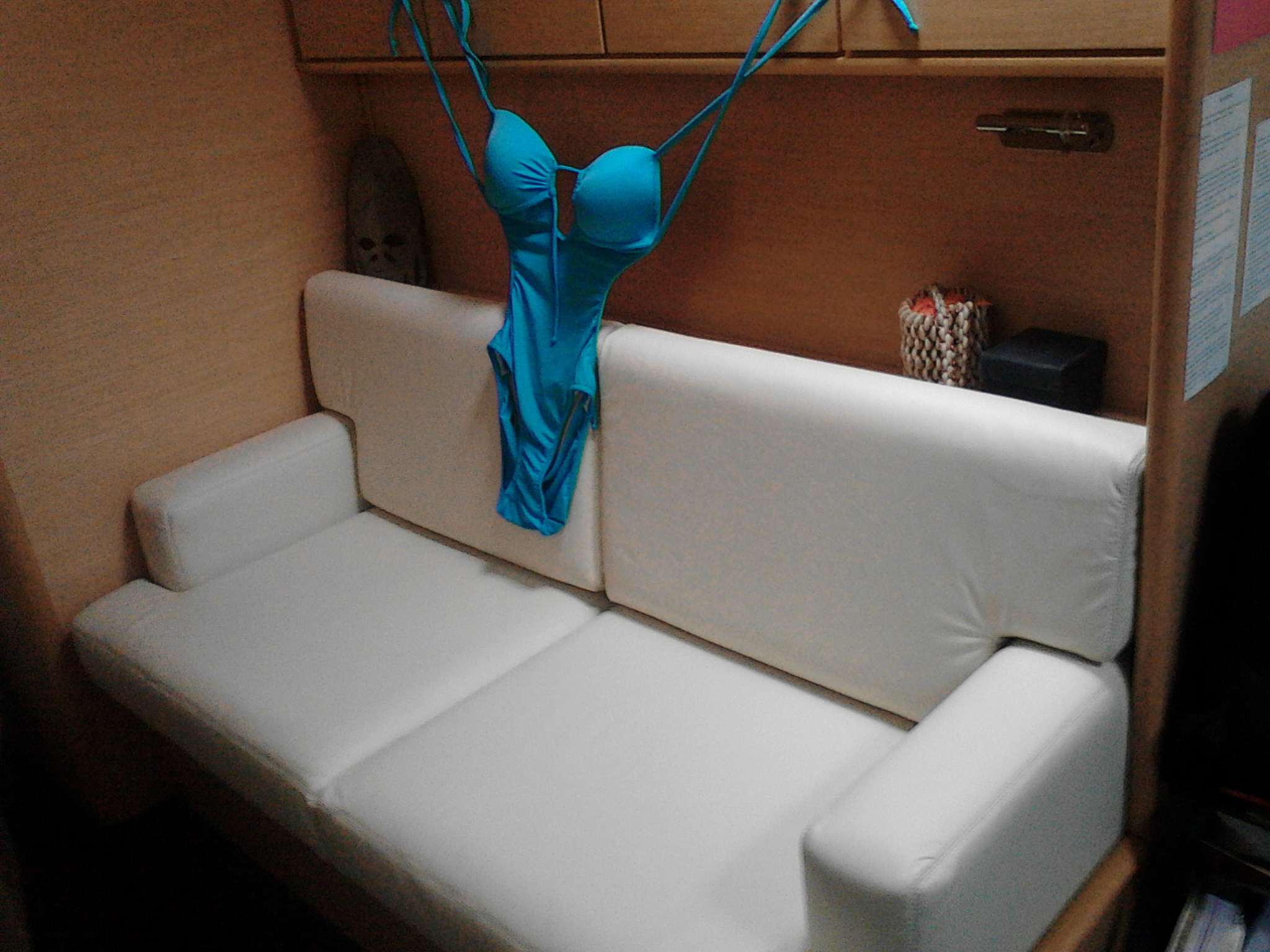
Our next stop was Milos, which has some of the best beaches in all of the Med. It’s also the home the famous statue “Venus de Milo”, which was found by a farmer in a field here and “sold” to the local French consul in the late 1800’s. (The more I tour local historical sites of ancient civilizations in this part of the world, the more angry I become that so many of the local treasures are now housed in museums in London, Paris, and Berlin.) We anchored in the southeast corner of the big harbor of Ornos Milou at 36°41′.475N, 24°26′.735E, which gave us the best available shelter from the meltemi. The were some boats on the other side of the bay that were getting smashed against the town quay in the 30 knot winds and 3 foot waves. We were safe. Jenna took our guests and the kiddies in the rental car for a day of beach excursions while I stayed on Sophie and did some Jamie work. Randy always wanted an upside-down backwards Speedo shot, and on Milos he made it happen. It was a great day for all of us.

20160615_173934

Sifnos
We really liked Sifnos and anchored in the double harbor of Faros on the south coast at 36°56′.341N, 24°44′.766E in 12 feet of turquoise water. Our anchorage only fit 5 other boats, including a big charter boat with a bunch of older French men and their “granddaughters.” We spent 2 days at Sifnos. The grownups enjoyed swimming, the kiddies enjoyed motoring around in our little “Baby” dinghy, and we all enjoyed eating at the local beachfront taverna 2 nights in a row. At this point we were really getting into the Eurocup football tournament and watched games both nights.
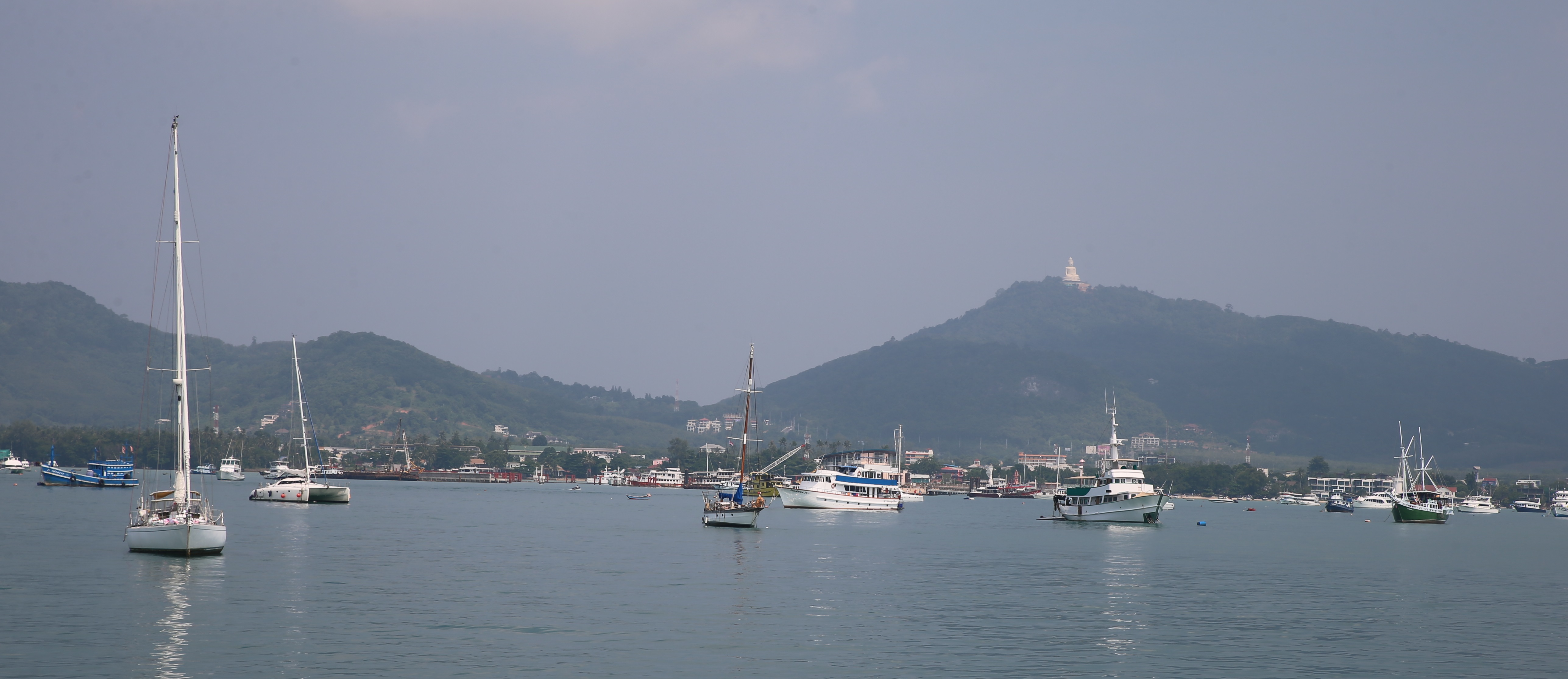
20160616_182132

Paros
After Sifnos we sailed our way over to Paros and anchored in the Ormos Plastira bay at 37°07′.475N, 25°13′.070E in 15 feet of water. We spent a few nights here enjoying a local beach with weird rock formations, a good local taverna for football, and excellent swimming. We also met the Lockharts, an English family that was taking a year off to explore the world. They have two boys, and it was great to see the kiddies have some playmates their own age.

2016-07-23 13.09.52 [17391]

Mikonos
We spent 8 days in Mikonos, partly to enjoy the nightlife and partly because we were pinned in by a strong northerly meltemi. Randy really wanted to experience the nightlife on Mikonos, and the island didn’t didn’t let him down (although we did miss Lindsay Lohan’s 30th birthday party here by ten days.) Mikonos has multiple anchorages along its south coast, all providing some shelter from the meltemi, but the wind coming off the mountains can really pick up. We spent our fist nights in the bay opposite the beach club Super Paradiso  (above) at 37°24′.761N, 25°22′.226E anchored off the beach in 40 feet of water. The beach club had over a thousand people along with a club dj playing boom boom house music. We rented a couple of beach umbrellas and soaked in the scene.

20160619_022731

Later that night the four grownups hitchhiked, walked, and cabbed around a headland to the nightclub Cabo Paradiso and stayed out until 4:00 AM! We definitely weren’t in Indonesia any more. Later that morning we moved east 3 bays to Kalafatis and anchored at 37°26′.436N, 25°25′.392E in 30 feet of sand off the beach. The beach clubs here were more family-oriented, we got to watch some some world-class windsurfing, and we celebrated some school milestones at an excellent Italian restaurant nearby. Later in the week we motored over to the main harbor of Ornos and encountered meltemi gusts of 40-50 knots along the way. We were worried we had made a big mistake as we entered the harbor, but found an anchoring spot in the lee of a cliff at 37°24′.922N, 25°19′.183E.

GREC6247

We could see big whitecaps 50 meters away from us in the main harbor, but we were sheltered in our little anchorage spot. We said our goodbyes to Randy and Susan, who pretty much had the best-ever Sophie Adventure Cruise of any of our guests over the last 3½ years. We then stayed tucked up against our nice cliff for another four days as we waited for the wind to die down. (Diva, the Bintang t-shirt is for you. Enjoy Indo!)

GREC6641

Delos and Rinia
When the meltemi finally subsided, we made a 5 mile trip on Sophie over to an anchorage on the east side of the island of Rinia (37°24′.521N, 25°14′.175E) from where we could take the dinghy to the amazing archaeological site at Delos. Delos is the mythical birthplace of Artemis and Apollo and served as the economic and cultural capital of the eastern Mediterreanan for 500 years. During our tour of the extensive and beautiful ruins, Hazel slipped and scraped her foot pretty badly, so I took her back to Sophie in the dinghy. The chop and wind had picked up significantly as we crossed the bay back to Rinia, so Hazel and I took Sophie right over to the day anchorage at Delos (37°23′.646N, 25°15′.788E), and collected Jenna and Leo after their tour.

20160626_202026Kythnos
After we were all back onboard Sophie on Delos, Jenna and I decided to make to the 40 mile late afternoon run over to Kythnos instead of spending the night on the south side of Rinia. For our first night on Kythnos, we anchored in the port of Loutro on the east side of the island in a quiet harbor with two other boats. We anchored at 37°23′.716N, 24°27′.494E in 50 of water with a lot of chain out. The next morning we motored around to the west side of Kythnos and dropped a hook in Ormos Fikiadha at 37°24′.823N, 24°22′.827E in 12 feet of sand. It was a wonderful, protected anchorage with a sand bar beach. At times there were 30 boats there, but that was OK because the swimming was excellent. There was a family taverna on a small cliff overlooking the beach, and a mile away was another bay with a taverna that showed football. We joined the Germans one night (above) and the French the next. Jenna and I even went on a date by ourselves at night with the dinghy to the town 3 miles away! We could have spent a month here on Kythnos and cannot wait to return.

GREC6751

Sounion
We eventually and reluctantly had to leave Kythnos to continue our journey north to visit with family in Montenegro, and we randomly picked Sounion as a halfway stop between Kythnos and Athens. What a halfway spot! Sounion is located at the southern tip of the Attic peninsula and features the Temple of Poseidon, one of the great preserved temples of ancient Greece. We anchored under the temple and wandered up the hill for a visit. Afterwards, a squall with 40+ knots of wind came through just as we were getting back on Sophie. We found ourselves anchored a little too close for comfort right under base of the cliffs and the temple. So we moved the boat to the middle of the harbor, with plenty of swinging room, and let out all of our chain in 35 feet of water. We survived the night and have a newfound respect for the god of the sea. Our final anchorage was at 37°39′.183N, 24°01′.327E.

20160630_085836

Athens
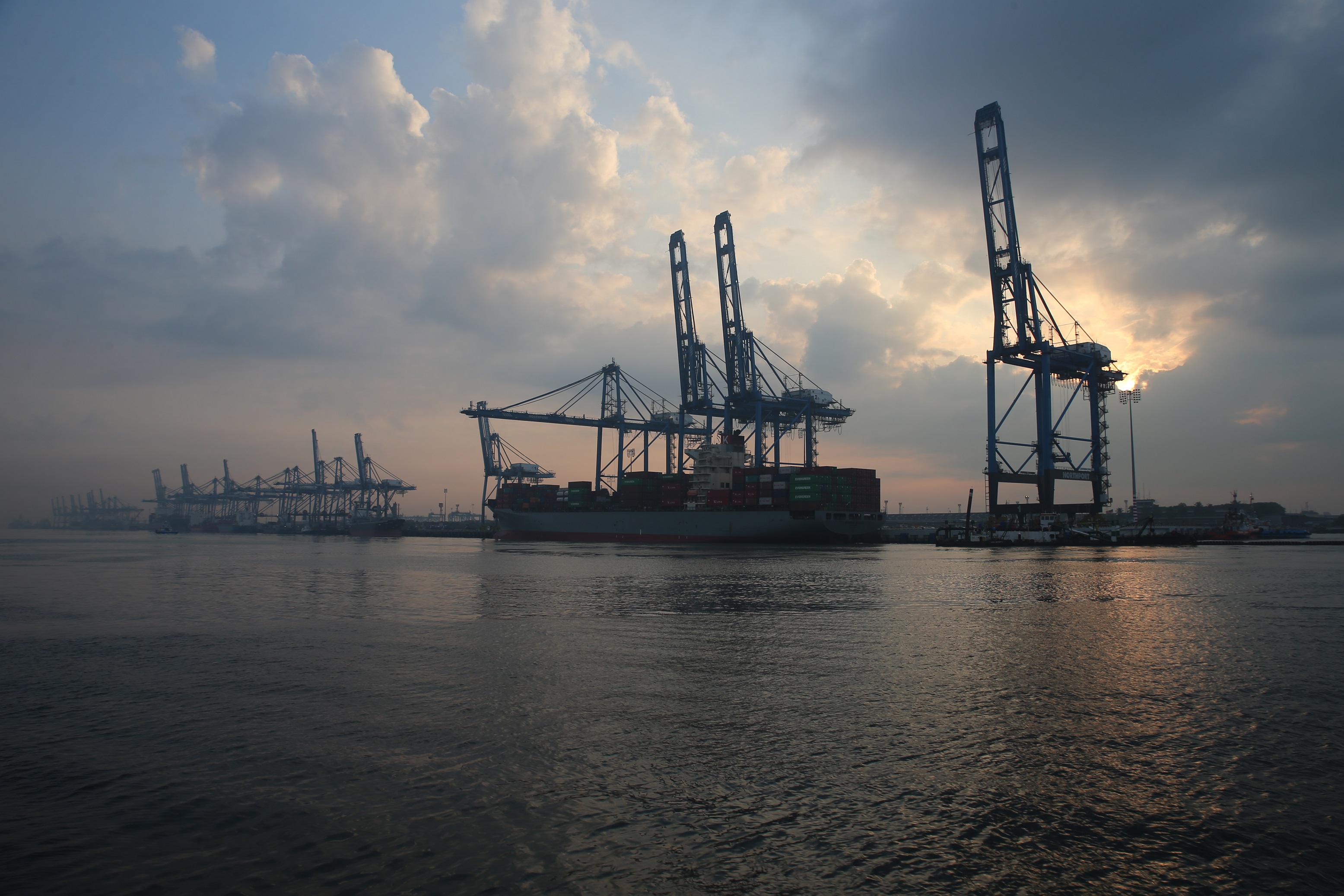
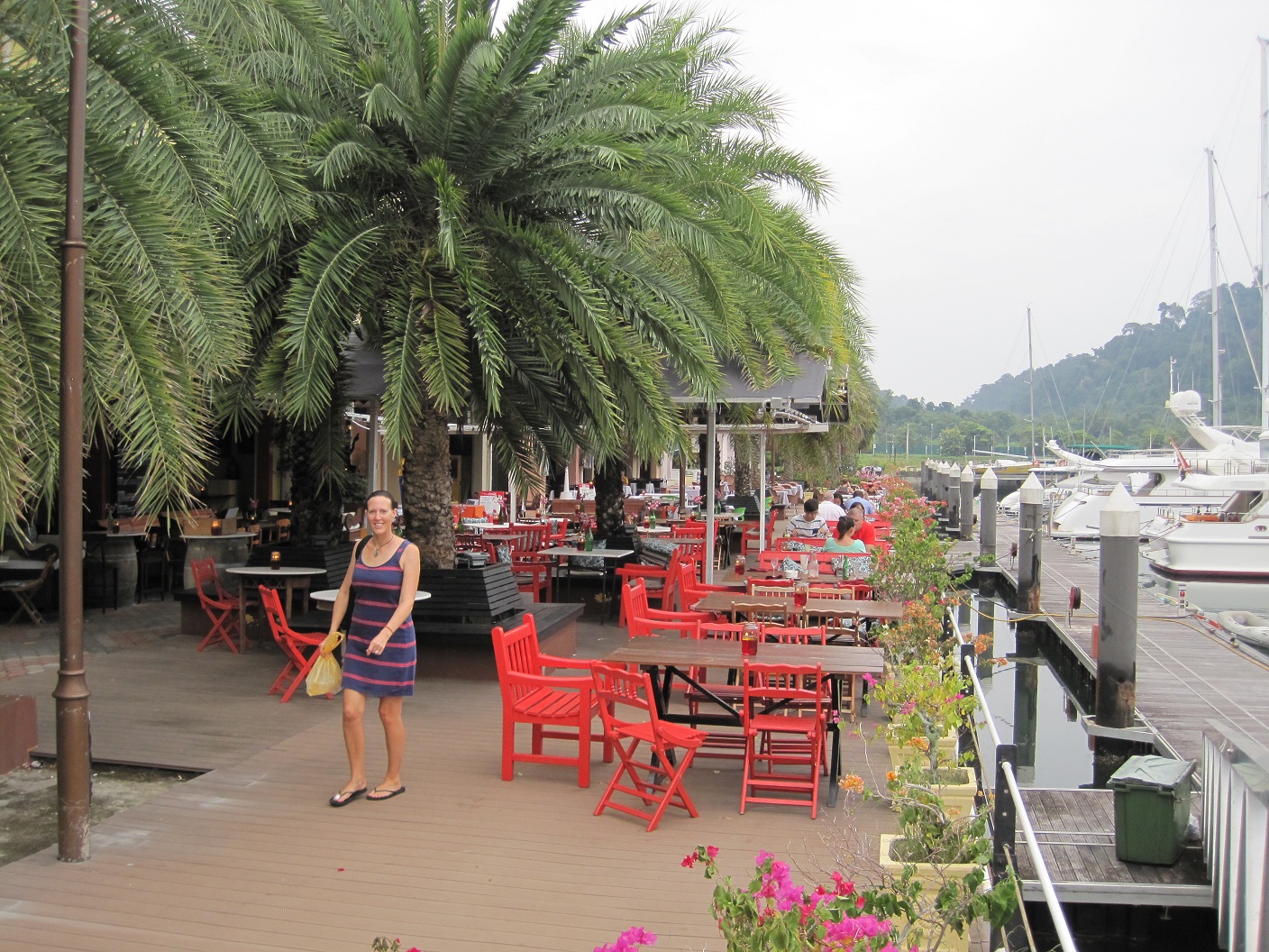
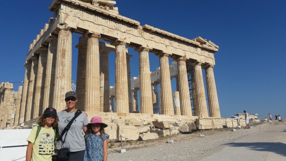
After Sounion we motored the 25 miles up to Athens and took a berth at the Zéa Marina in the Pereaeus district on the waterfront. There were over 40 superyachts in this 1,000 boat marina, but the marina staff tucked us onto a quay in front of the police station next to a collection of other cruising boats. We didn’t do much in our three days in Athens except visit the Acropolis, the Parthenon, the Erechtheon, the Theater of Dionysus, the Odeon of Herodes Atticus, the Areopagus, the Temple of Hephaestus, the Ancient Agora, the Stoa of Attica, the National Archaeological Museum, the National Gardens, the Zappio Megaro, Hadrian’s Arch, the Temple of Athena Nike, the Monastiraki District, the Plaka District, and the Temple of Olympian Zeus. We also squeezed in a playdate with the Lockharts at the local playground and wound up staying out all night with the parents watching the Eurocup and then dancing until dawn. Afterwards we took the subway with the kiddies to a mall and watched the film BFG.  My personal Athens highlight was wandering into a marine chandlery with Hazel and discovering that the store had the best inventory of Jabsco marine toilet spare parts I have ever encountered in my entire life! Better than Fisheries, better than West, better than any place in New Zealand. We’re talking electric Quiet Flush discharge ports right on the rack, right next to Pumpguard prefilter replacement screens! (No more finger cuts from cleaning worn out Pumpguard filters for me!) And the guy behind the counter knew his stuff. Indeed, Athens was a special place that we will never forget. At some point I assume Jenna will share a photo or two. 37°56′.062N, 23°38′.950E.

20160704_191823

Galaxidi (Via the Corinth Canal)
After an early departure from Zéa, we motored the 25 miles to the entrance of the Corinth Canal, a 3 mile long cut through a cliff that would save us 100 miles of beating against the meltemi if we went on the outside of the peninsula. We tied up to the Canal authority pier, paid our €280 transit fee, and then proceeded in a mini convoy through a 100 foot wide trench with 200 foot cliffs on either side of us. It was pretty cool.

IMG_2923 [22258]

After we exited the canal, we motored another 40 miles through the Gulf of Corinth and settled upon the little town of Galaxidi at 38°22′.863N, 22°23′.401E on the north side of the gulf. What a lovely little town! We anchored in 20 feet of sand off of an impromptu beach club at the tip of the village where a dj was spinning house music and families were enjoying their Saturday afternoon. There were three other boats in the anchorage, fifteen boats on the quay, and all of the tourists in the little town were Greek. We wound up spending three nights here and could have stayed a month. Jenna and I spent a night in the only taverna in town that showed football, and we were the only non-Greeks in the crowd. We made a day trip up into the mountains to visit Delphi, the holy site of Hellenic Greece, and soaked in the majesty of ancient civilizations. We swam in tranquil waters surrounded by mountains. It was yet again another special place.

20160706_073537 [20029]

Levkas
After we left Galaxidi, we exited the Gulf of Corinth, rounded the corner into the Ionian Sea, and made our way north to the island of Levkas for an overnight stop. We anchored in the big bay past town, surrounded by 50 other boats in 25 feet of water at 38°41′.344N, 20°42′.397E. We didn’t go to shore, but enjoyed a post-passage swim in the warm water. As we entered and exited Levkas, we passed by the private island of Skorpios, which used to be owned by Aristotle Onassis. He married Jackie Kennedy there in the 60’s. The island is now owned by the daughter of a Russian oligarch who made his money by consolidating control of Russia’s potash industry during the rise of Putin. He must be a clever man. Potash.

paros

Paxos
After our night in Levkas, we continued our northing to Paxos, where we anchored in another tourquoise lagoon at Lakka on the northern tip of the island. On our way, we transited Levkas Canal, a mile-long cut through a salt marsh. The canal is blocked at its northern tip by a ferry that serves as a bridge between the mainland and the island, and every hour the ferry sounds a horn, turns sideways, and lets the waiting boats pass by. It was pretty funny. When we arrived in Paxos, we wall-tied to a cliff in 15 feet of water in a small harbor with 50 other boats at 39°14′.259N, 20°07′.910E. At this point, Jenna and I were beginning to feel pretty good about our med-mooring and wall tying skills. There is a big charter industry in the northern Ionian, which explains the number of boats in the harbor, but the charter boats cleared out in a couple of days in order to return to their bases for the weekend transition to new clients. Apparently Thursday night in Lakka is Greek dancing night at one of the waterfront tavernas, but most people skipped that to watch Germany lose to France in the Eurocup. (Grrrrr). We spent 5 days in Lakka and loved every second. At this point, we had become comfortable sending the kiddies into town in the Baby in the mornings by themselves to buy bread and produce. It’s a significant point of pride and responsibility for them. We also became friends with a Spanish family with 10 year old twins (boy and girl), and the kiddies spent two days swimming back and forth between our boat and theirs. It was the sort of experience Jenna and I assumed we would encounter all of the time during our circumnavigation, and in Paxos it actually happened. We spent 5 days here and could easily spend an entire summer in the Ionian. Perhaps next year.

corfu

Corfu
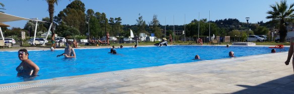
Our last stop in Greece was Gouvia Marina in Corfu, where we spent 2 nights hanging out and checking out of the country. This was another 1,000 boat marina, and they unfortunately lost our reservation as we approached, so they parked us at at 39°39′.002N, 19°50’887E on the far fringes of their docks, about a kilometer from the marina office. We weren’t able to see much of Corfu, but Jenna and I were able to see the Eurocup final at one of the marina bars. Hazel enjoyed the marina pool. We spent two nights eating at Harry’s Taverna, an excellent spot 4 blocks from the marina.

So that wraps up my initial summary of our trip across Greece. We are now stuck in Montenegro, surrounded by mountains, warm water, family, and a rich cultural history. Last night we participated in the annual ceremony where locals take their boats out to a man-made island in the bay and throw rocks into the water to continue to build up support around the church where my brother David and his wife Goga were married. It was part religious ceremony …

kotor1

… part water fight.

kotor2

We threw our rocks into the water and avoided any unnecessary splashing.

Have I mentioned lately how lucky we are?

Turkey is Not Southeast Asia or the Pacific

20160526_104731
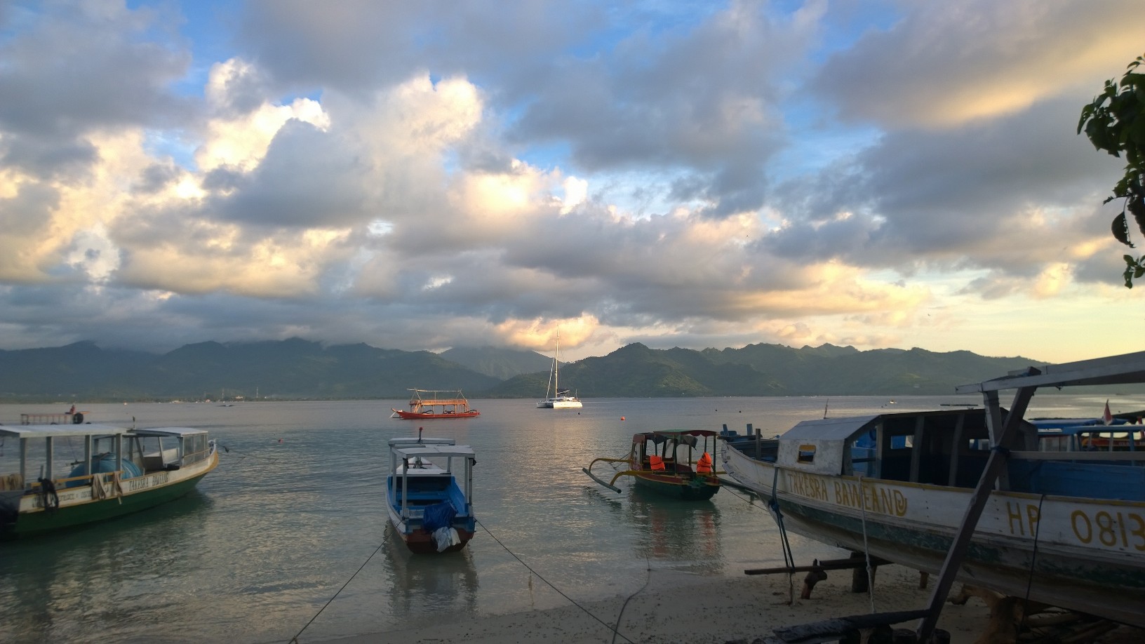
Sophie is currently moored in Sarsala in the Skopea Limani area of Turkey’s Lycean coast, just 5 miles south of Göcek. It is a pretty bay with a beach and a stunning view of nearby mountains. It feels like Desolation Sound back in British Columbia, except there are more tourists here. We will likely stay in the Göcek area for a week, focusing on Sophie school and boat projects. It’s quite a pleasant location.

Now that we have been cruising in Turkey for a couple of weeks, it’s time to share with you some early thoughts on how cruising here is different from cruising in Southeast Asia and the Pacific. We will also update you on some new additions to our home.

20160526_112702 [64226]

Cooler Weather Makes Our Machines Happier
The ambient temperature here is 20 degrees F lower than in Thailand, and this makes a big difference for how efficiently our machines work. As I’ve mentioned before, Sophie is simply a collection of different systems packaged together, and if the machines in these systems are happy, then Sophie is happy. We use Victron energy charger/inverters to charge our main battery bank, and they now run with up to 50% more efficiency in the cooler weather here, producing a peak charge of 180 amps (at 12 volts) compared to 110 amps in Thailand. The photo above shows 180 amps flowing into our main battery bank. This NEVER happened in the Pacific or in Asia. Never. The Victrons have internal sensors that reduce their charge when the machines get hot, and these sensors are apparently enjoying the cool Turkish spring. On the load side, our batteries are lasting longer between charges because our 2 refrigerators and 1 freezer aren’t working as hard in the cooler weather. Fewer people are opening up the fridges for cold drinks, and the machines’ compressors don’t have to work as hard to maintain their temperatures. Our watermaker also appears to be quite happy in the cooler weather, with less growth gunking up its filters. In Thailand we had to swap out the external filters every 2 weeks due to algae growth, but we haven’t had to change a filter since we passed through the Suez Canal. Our water tastes much better as well!

20160519_091116

No Tuna, But Plenty of Turtles and Goats
We have been trolling for fish since we left Cyprus but have experienced exactly zero fish action. We have not seen any offshore fishing boats, either. There are some small fishing boats using hand nets right outside of harbors, and the tourist restaurants all serve grilled fish that look like little sea perch. The village retail areas also have fishing stores that sell $500 fishing poles and buckets of lures to the tourists who come here to pursue their dreams. But there are no big pelagic fish. None. There are, however, thousands of sea turtles along this stretch of coast. No one ever told me that we would see more sea turtles in Turkey than in any other country on our adventure so far. Turtles are everywhere here. We have to dodge them in the dinghy. Some of them are big suckers, measuring more than a meter across. Apparently June is turtle egg-laying season, and there are many egg-laying beaches nearby. There are also goats on every hillside of every harbor and every bay. They seem to enjoy eating right next to where we tie our shore lines. I haven’t seen any gnaw marks on our lines yet, but I remain alert to the danger.

20160526_130506 [65795]

Fewer Cruisers, More Boats
There are a lot of boats out on the water here in Turkey, but almost all of them are charters or tour boats, and the people who charter boats use them every day. From our anchorage right now I can see three boats out sailing in the afternoon breeze. By comparison, I think we saw three sailboats during our entire passage across Indonesia. But we haven’t met any long-term cruisers since we were in Israel. It’s still off-season, and we are hopeful we will connect with some fellow cruisers soon. It was easy for us to do so in places like Thailand, because when you walk into the cruisers bar by the marina, there were … cruisers there! But it doesn’t seem to be the same here, at least so far. Also, most of the charter boats here in Turkey are US-flagged, because apparently our country is a tax haven for people who purchase and operate charter boats in Turkey.

20160526_105510

Our Lawn is Gone!
For the last three years we’ve had a patch of bright green seaweed growing at the end of our our stern transoms. Apparently the extra weight of all our systems, machines, and batteries pushes the last bits of transom into the water, and in the tropics the resulting warm water pools sitting in the bright sunshine become perfect growth environments for sea grass. This stuff was a bane of my existence throughout the Pacific and Indian oceans.  All the scrubbing, scraping, chemicals, and antifouling in the world couldn’t prevent this stuff from continuing to grow. We lovingly referred to these grass patches as our lawn. But now that we are in the Med, the lawn is suddenly … gone! Our transoms are bright and shiny. We hope this is due to the colder temperatures and not to the presence of some new type of poison in the water.

20160525_145026

Dust in the Wind
When we transited the Suez Canal, the boat became covered in a heavy layer of brown grit that blew in from the nearby desert. We assumed at the time that this was a minor price we had to pay for the convenience of sailing directly into the Med. However, we’ve been in the Med for a couple of months, and there is STILL a layer of brown dust that blows in from the nearby hills. Now that we are out anchoring, it seems crazy to run the watermaker for a couple of hours to produce enough fresh water to rinse off the boat if the boat will become covered with dust again in two days. It briefly rained last week, and the raindrops contained dust. In the Pacific, Sophie’s deck was clean due to the frequent rain, but Sophie’s waterline and back porch had a layer of green growth. In Turkey, the boat is dirtier due to dust-born wind, but the waterline and back porch are sparkly white. I am not sure which is better.

20160524_091242

We Finally Filled Our LPG Bottles!
We use LPG for cooking in our galley and on our barbecue. We use US-compliant LPG bottles, but unfortunately every nation has its own standards (meaning non-US compliant) for the fittings used to fill LPG bottles. This wasn’t a problem for us in the Pacific because the presence of so many American boats guaranteed that every port had the correct gear to refill US LPG bottles. We also didn’t use LPG as much due to the tropical climate. 100 degrees of ambient heat in the cabin is a great motivator to not bake. In Southeast Asia, it was more of a challenge for us to fill LPG but we always seemed to find a way. However, no one in Egypt, Israel, Cyprus, or Eastern Turkey could fill our LPG bottles. We were starting to worry, cutting back on our barbecues and use of the oven. I wandered Turkish ports with an empty LPG bottle in my backpack, visiting different shops hoping someone could help us out. For two weeks I had no luck. But I finally found someone in Göcek who could help (on my third stop of the day, no less!), and we now have enough cooking gas to get us to Italy. I think the girls plan to bake later today.

20160524_104817

No Dinghy Covers
In the Pacific and Southeast Asia, EVERY cruising dinghy has a canvas or Sunbrella cover over it’s tubes to protect the material from sun exposure. Here in Turkey, no one does this. It makes Sophie’s tenders stand out in a crowd.

IMG_0726 [59644]

Produce is Cheap, But Marinas and Restaurants Are $$$$$
We can go to a produce market here in Turkey and fill a big blue Ikea bag with just-picked tomatoes, cucumbers, eggplant, mint, basil, lettuce, peaches, green beans, and cherries for just 3 Euros for the entire bag. A loaf of fresh bread from a bakery costs 50 cents. On the other hand, a night on a dock in a marina costs over 100 Euros, and the nearby restaurants can charge that much for a meal for the 4 of us. Needless to say, we are enjoying our fresh produce while floating at anchor.

20160526_110614

We Love Love Love our Big Yellow Shorelines
When we lived in Seattle, we purchased a length of 20 mm floating polypropylene rope for stern tying to shore when we cruised Desolation Sound, the area back home that looks just like this anchorage. Specifically, I went to Fisheries Supply and asked to buy 100 meters of this type of rope. They had a brand new spool of 200 meters and offered to sell me the entire spool for an extra $25 dollars. I agreed, used the rope for a summer cruise in Canada, then buried it in Sophie’s forward lazarette for the next 6 years. Well, Turkey is shore tying country, and we are putting our 200 meters of floating rope to good use, doing so with a great deal of love and respect. It is quite easy to work with, especially when shore tying in a strong crosswind like we did the other day. We secured the line to a bollard on the cliff, had 100 meters of slack in the water while the wind blew Sophie parallel to the cliff, got the line onto one of our big genoa winches, and then cranked Sophie snug up to where she was supposed to be. It was awesome.

Well, that should give you a sense for how cruising in Turkey compares to cruising in the Pacific and Southeast Asia. It’s not better or worse, just different.

Here is an update on some of the projects we’ve been working on this past week:

20160525_161319

New Pasarelle
A pasarelle is a fancy name for the gangplank sailors in the Med use for getting on and off their boats when they are stern tied to a pier. Since all boats in the Med stern tie to piers while in harbor, pasarelles are mandatory equipment for cruising boats. For Sophie, we purchased and installed a 2.6 meter carbon fiber folding pasarelle made by GS-Composite in Slovenia.

20160526_105440

Its features include a nonskid surface, carbon fiber rails, a weight under 8 kilos, and a compact carrying bag for storage.

20160526_121157 [64759]

We installed a stainless steel mount for the pasarelle on one of our port transom steps and then spent some time playing geometry with the supporting halyard to make sure that the windmills don’t chop away at the halyard during a sudden wind shift. Hazel would like to use the pasarelle as a diving board.

20160525_143302

Bilge Pump for the Big Dinghy
Our friends (and fellow successful Indian Ocean and Red Sea passage makers!) Terry and Christine on Tekanova have the same model Highfield dinghy we have, and they installed an electric bilge pump on theirs. Jenna and I realized that we should probably do the same.

20160525_143241

While we were back in Seattle last month, I found a low profile Rule model that fits in the dinghy’s bilge without having to permanently prop open the dinghy’s little bilge grate.

20160525_143234

I did the wiring and installed a switch the other day. The new pump works great, and it means we will have a cleaner dinghy, because we will be more willing to hose it out when it’s in the water.

20160524_142803

Raymarine GPS Woes
Since we left Israel, we have been intermittently losing our GPS signal on our Raymarine G Series multifunction displays. These are our primary navigation computers, and this new problem is annoying. We have multiple backup GPS units on board, including a redundant set of Navionics charts on Jenna’s iPad, so technically this is not a dangerous situation for us. Our overall Raymarine system is 8 years old, and we increasingly find ourselves having to reconnect various connection points on the proprietary SeaTalk and SeaTalkng networks that connect all of this stuff together. (The more I cruise, the more I realize that marine electronics problems are usually due to a faulty connection somewhere.) We’re still tracking down where the bad connection is for this problem, and I even disassembled the Raymarine GPS antenna and replaced its lithium battery, but that does not seem to have completely fixed the problem.

20160525_171309

The Fleet is Out
Now that we are back in slow cruising mode, Jenna and the kids continue to focus on making great progress on Sophie School, and I continue to work through my list of boat chores and projects.

20160526_104633

At this point we have our entire “fleet” of cruising toys out on Sophie’s deck and ready to use: both paddle boards, both kayaks, both dinghies, and all four bikes. We call our small dinghy “The Baby”, and we haven’t used it since Thailand.

20160526_104709

In Europe, The Baby will be the main vehicle the kiddies use for getting to shore on their own, most likely starting today once school is over.

20160526_105721

Next Steps for Sophie
We plan to slowly move ourselves along the Turkish coast for another couple of weeks before we meet some Seattle friends in Greece. We will spend a month in Greece, then head up to Montenegro and Croatia for July and August. We would like to spend the fall and winter in Italy and will try to get visitor visas for Italy to avoid the restrictions of Shengen visas (where you can only stay 90 out of every 180 days in most EU countries.)

As usual, time seems to be going by way too quickly. We are very very lucky to be spending our lives doing this. It’s all good.

20160517_055929

Sophie’s Thai Makeover

IMG20150818182021

Thailand is a great place to relax. It’s also a great place for cruisers to get stuff done.

It has been 18 months since Sophie left New Zealand, which is the last place where we had significant work done on the boat. Most of the repairs we did in New Zealand were structural in nature, including re-glassing some bulkheads, machining our roller furling foil, machining our boom gooseneck, and installing new rudder bearings.

Now that we are in Thailand, it’s time to take advantage of the excellent and inexpensive marine services industry here and have some new work done to our home. Most of the additions to Sophie this time are in response to the ongoing, relentless onslaught of the tropical sun. We are very excited about these upgrades, which are making our home look shiny and new.

Sophie is our home, our classroom, our workplace, our movie theater, our garage, our laundromat, our power plant, our municipal water and sewage service, and our dance floor. Don’t forget about the dance floor part. It’s the platform for Sophie Adventure Cruises, our nickname for how we go about sharing our lives with friends and family. Any time we do upgrades here, it’s a big deal for us.

We’ve just done some upgrades that make us happy in a Christmas morning-kind-of-way. Let me walk you through what we’ve done so far.

Our New Ride

Sophie has a new dinghy! When you are out cruising, your dinghy is your car. You use it for everything. Sophie’s old dinghy was a Walker Bay Genesis RIB with a 20 HP Honda four stroke outboard. We bought it new in 2008. It was a great dinghy for a long time, but over the last two years it’s fabric began to fray, it’s hull began to leak, and the engine became so finicky that I was the only one in the family (including #Stepheniswinning) who could start it.

Jenna, in particular, did not enjoy having a dinghy that she couldn’t start, especially after she was caught out in rain squalls once or twice. So for the last six months we’ve been dinghy shopping.

We settled on a Highfield Ocean Master 3.5 meter RIB with a 30 HP Tohatsu 2 stroke outboard and Hypalon tubes, all purchased from Cholamark Boats in Phuket. We first rode in a Highfield with our friends on Nalukai last Christmas. Our new dinghy has a heavy duty, reinforced aluminum double hull, which will be strong enough to withstand the demands that Sophie Adventure Cruises puts on a tender. We also ordered a Sunbrella tube cover in “Sophie Green” along with a grey engine cover.

The boat is designed for a center console with steering wheel, but we decided to forego this option. The result is a cavernous interior that will hold 8 adults, and we think that the Tohatsu has enough oomph to get up on a plane with such a heavy load. Please also note the aluminum transom reinforcements, the multiple welded attach points for lines, and the nonskid surface on the deck.

We like the design of the bow. It features a cushioned seat with an integrated 35 liter fuel tank and fuel gauge. Above that is a nonskid bow platform with a cleat and anchor roller. It’s now quite pleasant to step down from the dinghy onto Sophie’s transom.

The bow platform also makes an excellent launch pad for doing can openers.

On the transom, we mounted Beach Master retractable wheels. (Yes, I know, an Ocean Master needs a Beach Master.) These are made in New Zealand and are easily the strongest dinghy wheels we’ve seen yet.

They’ve worked flawlessly on five beaches so far, including a landing amidst the chaos known as Maya Beach on Phi Phi Le. The only downside to this arrangement is that the weight of the fuel tank is now located in the bow, requiring someone with the strength of a bull to lift and pull from the front of the cart.

The best part of the new dinghy? It has an electric starter, powered by a battery located in this cute little box. Actually, this is a wonderful feature, especially after the last 5 months of prayers and frustration that were often required to get our old dinghy running. The best part of the new dinghy is the confidence it gives us to go longer distances, crushing through waves in the process. We’ve already done a 10 mile trip with #Stepheniswinning, and we hope there will be many more to come.

Our New Baby

We liked the idea of buying a new dinghy so much, we bought two! This is a Highfield 2.5 meter Roll-Up with Hypalon tubes, a 3.5 HP Tohatsu 2 stroke outboard, and Sunbrella covers that match the covers on her older sibling. We call this craft “The Baby,” and the name works. The Baby weighs 50 pounds, including the motor.

When we are underway, we can deflate The Baby, roll it up into a bag, and store it in a locker. We will mount the engine on a stern rail.

It’s quite common for cruisers on bigger boats to have a second, smaller dinghy. Small dinghies are easy for two people to carry up a beach if you are landing in surf. They are useful for exploring shallow waters, including the Hongs here in Thailand. They make great platforms for the kids. We told Leo and Hazel that they could drive The Baby on their own once they had read the engine manual and passed a driving test. It was so much fun to watch Hazel sitting in the dinghy, Tohatsu manual in hand, going over the different parts of the motor for over an hour. She started the engine on her own yesterday, and 30 minutes later was giving her mother instructions on how to drive The Baby. Living the dream …

New Exterior Cushions

The tropical climate has been especially harsh on our exterior cushions over the last two years. The stitching was disintegrating, interior foam had deteriorated, and the white vinyl surfaces had turned a grayish-black. I had tried every combination of cleaner-detergent-vinegar-bleach-shamanism imaginable, but the original color wasn’t coming back. So we replaced them all with new cushions made from closed cell foam and with a slightly more ergonomic design. The overall effect is to make Sophie look brighter and cleaner. For the flybridge, we even added circular cushion back rests. These make Jenna very happy.

The forward cockpit looks clean and inviting, especially for couples at sunset.

The aft cockpit looks like children have never visited the boat. For now.

Addressing UV Damage on the Flybridge
Sophie’s flybridge, the place up top where we steer and sail the boat, is very exposed to the sun. Some of the material up there required repairs or replacements.

Our bimini, which we rarely used in Seattle but has been up pretty much nonstop for the last the three years, was starting to lose it’s seams and stitching along the zippers. We had them all repaired.

The same goes for our wheel cover.

We have mesh netting on the rope wells on either side of the wheel. The old netting had disintegrated. The new netting looks quite nice.

New SUP Covers

We love our stand up paddleboards, but the plastic travel bags we bought for them in San Diego 30 months ago started to leave a trail of silver dust behind them wherever they went. Two months ago, they literally disintegrated and turned to dust wherever you touched them. These new covers are made from Sunbrella and will hopefully last longer.

New Interior Leather

Sophie’s salon cushions and master cabin couch cushions were originally covered in ultrasuede, and we could run these cushion covers through the washing machine whenever they started to get dirty. But the tropics eventually took their toll, and everything soon became a dull, spotted grey. We met some friends in Langkawi who had switched to leather about four years ago, and their interior looks great. We decided to take the plunge. From my perspective the salon looks brand new, but I am a little scared to sit on them.

IMG20150826163051

I think that the sofa in our cabin looks great as well. I especially like Hazel’s invention for opening cabinets at the pull of a string.

New Ink
Not all of our Thai cosmetic upgrades happened to Sophie over the last month. The crew got some cosmetic upgrades as well, in the form of tattoos.

As we’ve mentioned previously in this blog, we’ve added five tattoos to Sophie’s crew since we started this adventure. Jenna, Dan, Max, Becca and I all got tattoos in French Polynesia. Now that we are in Thailand,  #Stepheniswinning and I decided early on in his trip that it was time for two more. We found an interesting tattoo parlor in Phi Phi with an excellent artist who used traditional bamboo and decided to give it a go.

This is Stephen’s first tattoo, and we all really like the design. It was also a little scary watching a guy wearing a Steelers shirt jab bamboo needles into the arm of a guy wearing a Pats shirt. But it was all good in the end.

This is my eighth tattoo and the second one that is not cancer-related. Some day I plan to have as many tattoos that I chose as I had from my cancer treatment. “Were’d you go?” is the chorus to a Clash song I used to sing with my older children when they were kids. It’s a reminder to me that I have a bigger family than the ones who are fortunate enough to be with me right now. It’s about travel, expectations, culture, experience, separation, loss, and hope.

To me, it’s perfect. Just like all of the fancy new upgrades to our little floating home. New dinghies, cushions, canvas, leather, and ink. Have I mentioned lately how lucky we are?

Anchorages and MARINAS from Singapore to Phuket

IMG_1178Here is another post for boats following in our footsteps, where we document our stops on this 500 mile stretch of water in Malaysia and Thailand. Please note that this is the first time I am doing one of these waypoint blog posts where I include information on multiple marinas where we stopped. Yes, marinas. We’re not in Tonga any more.

Before we left Singapore, we were told that boats were fleeing Phuket to avoid the rainy, windy season known as the “southwest monsoon.”  The best time to head north to Thailand was during the “northeast monsoon” between November and March, when the weather is drier, the water is clearer, and a gentle wind blows from the land.

Now that we are up in Phuket, people here are telling us that the concept of a summertime southwest monsoon — aka the bad, rainy season — has become increasingly irrelevant. Perhaps it is a result of global warming. Our weather has been sunny, the water is clear, and the winds are quite gentle. For us, this has been a great time to begin exploring Thailand. And we recommend all of the anchorages and stops in this post to boats following us, with the exception of the anchorage in Telaga if the weather is squally.

Pulau Pisang
01.28.817N, 103.14.721E
We anchored behind this island on our first stop in Malaysia. It’s about 40 miles up the Malacca Strait from Singapore. It was nice to be on the hook again after a month of city life in a marina. Good holding in 20 feet of water. It was calm enough for me to scrape Singapore barnacles off our hull and props.

Pulau Besar
02.06.603N, 102.20.629E
This was another anchorage 70 miles up the strait from Pisang. We wound up anchoring on the south side of the island because it was getting dark when we arrived. It was little rolly.

Port Dickson
Admiral Marina
02.28.573N, 101.50.704E
marinaWe stayed at this marina for almost a week, using it as our home base for Sophie during our three day visit to Kuala Lumpur. The marina is clean and the staff was helpful. Their fuel dock was broken, but they brought 800 liters of diesel in jerrycans to Sophie’s dock. Once again, I got to pour them into our tanks. It was character building. The marina has a pool and an air conditioned bar with WiFi. That’s about it. We took a cab for the ten minute ride into town to clear into Malaysia Immigration/Customs/Harbormaster. It was a straightforward and friendly process. TripAdvisor claims that the best restaurant in Port Dickson is a pizza place by the beach. Do not eat there. In hindsight, we regret not making the effort to visit Melaka on a day trip, which is supposed to be beautiful and historic. But after our time in Singapore and Kuala Lumpur, we wanted to get back into cruising mode.

Port Klang
Royal Selangor Yacht Club (RSYC)
03.00.322N, 101.23.413E
MLYS1999This was our next stop up the coast, and we docked in front of a beautiful facility on the river that connects Kuala Lumpur with the Indian Ocean. There was a strong current in the river, and Sophie strained against the floating dock. The RSYC has a reciprocal relationship with the Seattle Yacht Club, and during our visit we met the RSYC commodore and exchanged burgees with him. They had a big restaurant, a good bar, and a nice pool. We stayed two nights.

Pangkor Marina (Marina Island)
Pangkor
04.12.685N, 100.36.074E
MLYS2012Our next stop was 40 miles up the coast from Klang, and our arrival here was a little stressful. The sun was setting, we were hit by a squall, the marina entrance was not clearly marked on our charts, and we had to motor 3 miles past the marina to avoid a big reef that runs north-south through the channel. Other than that, it was great. The marina looks like it will be an awesome facility when construction is completed in 3 years. They have a boatyard with a haulout that is big enough to lift Sophie. And we met Jack and Jackie on Barbara Ann, who have subsequently become our friends.

Straits Quay Marina
Penang
05.27.539N, 100.19.094E
IMG_1012We loved loved loved Penang. It was a 90 mile run up the coast from Pangkor, a longer trip for Sophie than for most boats, because our mast cannot fit under the two bridges that connect Pulau Penang with the mainland. For our first night we anchored outside of the marina, but it was rolly. For the next 6 days we had a dock at this friendly and inexpensive marina with a promenade featuring 10 restaurants. Nearby access to two supermarkets for provisioning. Easy access into town. Great culture. Monkeys who steal beer. Penang has it all.

Kuah, Langkawi
06.18.733N, 099.50.801E
This was our first stop in Langkawi, and we stayed here for one night. There was excellent holding for our anchor, and we could easily check in to Immigration and the Harbormaster. The marina at Kuah was under construction, which made it off-limits for us. The city itself reminded us of Indonesian cities like Ambon or Sorong, full of small businesses but not easily walkable, so we moved on.

Telaga, Langkawi
06.21.764N, 099.40.677E
telagaWe spent over two weeks here, first in the anchorage and then in the marina. It is a great spot, and we will return here later this year. The holding in the anchorage was terrible, and multiple boats (including Sophie) dragged their anchors during squalls. The marina was much more protected and featured several excellent, inexpensive restaurants. They also had a machine that used an electric motor to pump diesel fuel directly into your boat. This was a first for us in almost 10 months. It is easy to rent a car for a day to head into town. Langkawi is a duty free port, which means there are no taxes paid for alcohol or for boat parts you ship in from the United States.

Pulau Singa Besar, Langkawi
06.13.598N, 099.44.800E
MLYS2857We left Telaga for 5 days with our friends Misti and Abi to enjoy watersports in this anchorage 9 miles south of Telaga. We swam, paddleboarded, barbecued, drank, and played a lot of board games. We were back in Sophie Adventure Cruises mode, and it was a lot of fun. We were told that a local cruiser organizes impromptu bonfire singalongs on the beach here every Saturday night, but he had to cancel the week we were there.

Ko Lipe, Thailand
06.29.651N, 099.17.774E
IMG20150722183737We finally left Malaysia and spent two nights anchored on the north side of Ko Lipe. We never went to shore and instead spent our time padleboarding, swimming, and conducting Sophie School. The Ko Lipe area is part of a National Park, and we used a park service mooring even though we were warned to not trust any moorings in Thailand. After we tied up to the mooring, we ran both engines in reverse at 2000 RPMs, and nothing broke. Ko Lipe becomes much more crowded with the beginning of the high season in November, and we will return.

Ko Tarutao
06.42.456N, 099.40.072E
THAI3030After Ko Lipe we motored 25 miles east to visit another Thai National Park at Ko Turatao. Initially we anchored on the northwest tip of the island (06.41.764N, 099.38.249E) in order to visit “Crocodile Cave”, a spot where you pull yourself a couple of hundred meters along a rope on a raft to check out stalagmites and bats. But as we motored a mile up the mangrove in our dingy to reach the cave entrance, we saw a massive thunderboomer cloud approaching from the east. Our dingy motor has been a little tenuous lately, and Sophie was anchored in a very exposed area. So we punted on the idea of the cave (for now), got back to the boat, and motored around the corner to a much more sheltered anchorage. We anchored in 40 feet of water and marveled at the hundreds of basketball-sized jellyfish slowly bouncing around the bay. We did not swim.

Ko Rok Nok, Ko Rok Nai
07.12.815N, 099.04.156E
THAI3018Our next stop was another Thai national park, and we picked up a mooring in the channel between these two small islands. Our first week of “monsoon” weather in Thailand was perfect, the water was crystal clear, and there were thousands of reef fish swimming under Sophie. We enjoyed a grand afternoon cavorting in the water. The next morning a bit of a squall showed up, and we were directly exposed to a southerly wind that would have pushed us onto a reef in about 5 seconds if our mooring line broke. We decided to leave that morning, knowing full well that we will return.

Ko Phi Phi Don, Ton Sai Bay
07.44.051N, 098.46.304E
WP_20150727_002Phi Phi Don is a backpacker tourist island and is very, very cool. We anchored in the main harbor, slightly to the west of the route that the ferries, speedboats, and longtails use. Next time we’ll anchor to the west, away from the traffic and closer to the wall. The village reminded us of a bigger version of Gili Air, with 10 blocks of walking streets filled with backpacker bars, dive shops, tattoo parlors, and foot massage stands. Wandering these streets were Russian girls in bikinis and Australian bros with bad tats and hats, and everyone seemed to be having a good time. We stayed two nights and enjoyed some great people watching. We also caught up with our friends on Garuça Cat, whom we hadn’t seen since Bali. We will definitely be taking our nephews Steven and Dan here when they visit in the next few months.

Ko Phi Phi Le, Maya Bay
07.40.815N, 098.45.847E
pp1This day stop was literally spectacular, meaning “of or like a spectacle; marked by or given to an impressive, large-scale display.” Phi Phi Le is where the Leo DiCaprio movie “The Beach” was filmed, and it is apparently a required stop for every tourist who visits Phuket, which is 20 miles away. We arrived at 7:00 AM to grab one of the few mooring balls there, and by noon we counted over 50 high speed (500-1000+ hp outboards) tourist boats in the little bay. They would roar in, wait for their landing instructions from the BTC (Beach Traffic Controller), drop a sand hook off their bow, back 150 feet up to the beach, unload 20 tourists, then roar away. We counted a couple dozen of these boats lined up on the beach at one time, and later heard that during high season there are 2,000 boat trips a day to this little bay. Thankfully there is buoyed off swim area on the beach, and we simply sat in the water and marveled at the spectacle of thousands of tourists doing spinning panorama shots of themselves with their GoPros on selfie sticks. 

pplRemember, we’ve had most tropical beaches to ourselves for the last year, and this was a little more crowded. Phi Phi Le is a National Park, and we had to pay a beach landing fee of $40 for the family to enjoy the scene. It was worth every penny.

Ko Phi Phi Don, Laem Thong
07.46.744N, 098.45.956EWP_20150728_001
After the spectacle, we motored back up to Phi Phi Don and dropped the hook off of the sea gypsy village on the northeast coast of the island. It has a beautiful beach, nice coral, and wasn’t very crowded. There is a beach bar there named Jasmin, and we enjoyed a seven hour meal there, swapping stories with Peter, the Scot who’s married to Jasmin and serves as the restaurant’s official greeter and beer pourer. IMG20150728174023He’s quite a character, telling stories about Leo DiCaprio, Amy Winehouse, and his dark past in London. We will definitely be back.

Chalong, Phuket
07.48.965N, 098.21.574E
chalongWe could have stayed in the Phi Phi for a month (the kiddies never get tired of the fact that the islands’ name is pronounced “pee pee”), but we needed to officially check into Thailand so we motored over to Chalong harbor on the southern end of Phuket. On our way we caught our first tuna since November, thanks to advice we got from Peter. Apparently tuna and whale sharks are running through the islands here for the next few months, so we’ve got our lines back out after months of the fish nothingness that is otherwise known as Indonesia. Chalong has a one stop check-in center (Immigration, Customs, Harbormaster) all located in a single building at the end of a big pier that juts into the crowded harbor. Better yet, these different agencies use computers to share your information across their offices, so we only had to fill out a form one time, and that was on a computer! Amazing. We only spent one night here and anchored out from the main fleet. There are plenty of bars and tourist restaurants in the area, but we only stayed one night.

I continue to write on this blog that things on our little adventure keep getting better and better, and at some point you might begin to think that I am guilty of exaggeration. How could this be possible?

Come to Thailand, and you’ll understand.

Telaga

IMG_1136

Greetings from Telaga, a small harbor on the island of Langkawi on the northwest coast of Malaysia. This will be our home base for the next four weeks. Our current location is 06.21.743 North, 099.40.669 East. Sophie is now 1,299 miles from Bali, 4,935 miles from Auckland, and only 1,212 miles to Chennai on the Indian subcontinent. We definitely seem to be zipping along, but we will spend the next seven months hanging out between here and Phuket, Thailand, which is only 110 miles to the north.

IMG_1170

For the first time since Vanuatu, we fee like we are back in “cruising country.” We are anchored in a small bay with 30 other sailboats, right outside of a marina holding another 50 boats. There’s no real town here, so you have to either rent a car or take a taxi to Langkawi’s commercial center of Kuah if you want to provision. But Telaga harbor boasts a waterfront promenade with outdoor restaurants featuring tapas, Italian, Indian, French, Chinese, and Lebanese food. Meal prices range from $2 to $15 (for filet mignon), and beers cost around a buck.

Did I mention that there are 80 boats here?

The promenade also features flowers, palm trees, and a smiling Jenna, as you can see from the photo at the top of the blog.

IMG_1171

Our harbor is protected from the Malacca Strait by two small manmade island that are uninhabited. These have been used as little adventure playgrounds by cruising kids for years, but recently a sign went up declaring Private Property: Anyone Caught Hunting, Fishing, Swimming, or Trespassing Will Be Prosecuted. That didn’t stop Leo and Hazel from spending the afternoon there with their new friend Jana from Momo, because the kids were playing, an activity not specifically covered by the directions on the sign. They did pick up one of their best sunburns of the entire trip, which I think from their perspective was a small price to pay in return for getting an entire afternoon by themselves without parents on their own island.

IMG_6524One of the nice things about spending time in a secure anchorage in a place without too many shore side distractions is that it creates an environment where the kiddies can focus on their schoolwork. This photo isn’t staged, Leo actually likes Sophie school.

IMG_1148

Leo’s hard work is paying off, because he achieved an important milestone this week by completing 50% of his fifth grade curriculum. We keep a chart on a bulkhead to track the kids’ progress in Sophie School, and Leo was quite happy to fill in his 50% box.

IMG_6520

Leo isn’t the only one on board who is working hard and achieving milestones at school. We are happy to report that Hazel has completed second grade! We are so proud of the effort and dedication both she and Leo put into their schoolwork. Hazel is especially good at getting herself up early and starting schoolwork before anyone else wakes up. Her dad used to deliver newspapers before school when he was a boy, and I guess this is one apple that hasn’t fallen far from the tree.

IMG_1168Now that school is over, Hazel has apparently discovered other ways to occupy herself before everyone else on the boat wakes up. This morning, she looked up from her magazine and said “Dad, can you believe that there is a movie star that loves her butt? She even pays someone to clean and polish it. That’s ridiculous!” I asked her if this person was named Kim Kardashian. Hazel put her hands up to cover her mouth, an endearing trait of hers when she is feeling a little shy, and giggled, “Yes.”

Until today, our children lived in a world where the Kardashians did not exist. Pretty cool.

IMG_1134

We have been enjoying mostly sunny and dry weather since we arrived here, which of course is not supposed to happen during this rainy monsoon time of year. The kids have been hoping for a “Sumatra,” the name for vicious squalls that form over Sumatra and then hit this coast during this monsoon. They can bring 50+ knot winds, lightning strikes, waterspouts, and cloudbanks that look like a black wall of death. Leo even wrote a report on them.

We were hit by a squall the other day, but it’s subject to an ongoing debate as to whether or not it was a Sumatra. We had gusts that exceeded 40 knots and cycled around 360 degrees. But the black clouds came mostly from the mountains.

The squall hit us in the middle of the day, and in our scramble to gather laundry and tie down the surfboard, Jenna unfortunately slammed her foot into a little plastic hose nozzle that has fallen off the aft cockpit counter and lodged in the teak grate right outside of the cabin entrance. We are not sure if it is broken, but it hurts like heck.

So there you have it. We are back in a tropical paradise with new friends, deserted kiddy play islands, great focus on Sophie school, inexpensive and delicious food, and 50 cent happy hour beers. On the downside, my wife is hobbling, and we now all know that we live in a world where the Kardashians are popular.

On balance, I think we’ll take it. But that’s easy for me to say because I’m not the one with a broken toe.

Anchorages from Bali to Singapore

opnHere is another one for boats following in our footsteps, where we provide waypoints and advice on the different places where we have stopped over the last few months.

Before we entered Indonesia, we knew very little about this leg of our trip. Would we have run-ins with pirates? Would we encounter massive standing waves and rip tides that would send us sideways? Would the predominately Muslim population present problems for a boat full of Americans?

The thousand miles we covered from Bali to Singapore proved to be uneventful, with little wind during this transition period between the monsoon seasons. The people we met were uniformly kind, the fishermen all smiled and waved, and we experienced some of the best wildlife and snorkeling of our entire journey during this leg. We’ll come back here again some day.

seranganPulau Serangan, Bali
08.43.100S 115.14.823E
This was our home while we visited Bali for over a month. Serangan is the main mooring and fishing boat anchorage on Bali’s west coast, and although the harbor is filled with hundreds of mooring buoys that you can rent, we anchored in 30 feet of mud on the eastern side of the harbor with 5 other sailboats. It was a secure spot, and we never dragged even during a 50 knot squall. The location is a short dinghy ride to the beaches of Sanur, but a huge mud flat appears in front of Sanur at low tide. I broke one of our dinghy wheels crossing it. A neighboring boat would frequently leave their dinghy at the park at Sanur, but they were often hassled and at one point even found sand poured into their gasoline tank. Instead, we would leave our dinghy on the inside of the ferry dock in the middle of Serangan harbor. We never had a problem, even at night, but it meant we had to take Blue Bird taxis to get anywhere in Bali. They have an app you can download to your phone, so at least they are reliable. We could buy diesel and gasoline in Serangan. Overall it was a quiet anchorage with pleasant people. We never wanted to swim here, however.

lbnPulau Lembongan
08.40.675 S, 115.26.293E
This is a resort anchorage used mostly by day trippers coming over from Bali. A large reef provides shelter from northerlies. We stayed here on two separate occasions, and on both visits we grabbed a mooring near the tour boats in 20 feet of water. No one came by to collect money. We loved swimming in the clear water after a month of Serangan’s mud. The harbor gets loud during the day but quiets down after 3:00 PM when the tourists leave. Note that Selat Lombok can have a 5 knot south-setting current, so when heading north it’s best to hug the Bali coast before turning right for Lembongan. You need REALLY to do this if heading north to the Gili Islands or you run the risk of having the current deposit you in Darwin.

gili2Gili Air
08.21.948 S, 116.04.932 E
We visited Gili Air twice, once on our way into Bali and once on our way out. The anchorage is protected by reefs, and we picked up a mooring on each visit. We were only charged during our first visit. Gili is a laid back tourist spot with no cars and a sand path that circles the island. Little horse carts are used to haul food and luggage to the hotels. There is supposed to be excellent snorkeling nearby. We wound up leaving our dinghy tied to the inside of the ferry dock. It was safe there, but little school kids enjoyed swimming off it. There are no stores or diesel available at Gili, but we ate in the beachfront restaurants every night. The kiddies didn’t complain too much.

Pulau Kangean
06.51.511S, 115.13.943E
After Gili we did a 110 mile overnight run to Kangean. It was a beautiful and sheltered harbor, and we anchored in 50 feet of mud a little east of the navigation marker. We enjoyed the sun and the fact we were out in a quiet anchorage for the first time in over a month. There were a couple of small fishing villages onshore and a nice-looking beach that was crowded with fishing boats, but we opted to hang out and rest.

post giliPulau Bawean
05.43.796S 112.40.200E
We sailed another 160 northwest from Kangean to Pulau Bawean, another sheltered stopover on our way to Kumai. This island was bigger and more developed than Kangean, and we shared our anchorage with several fishing boats. It’s important to note that fishing boats are now ubiquitous, and we have to pay careful attention to avoid their nets. We anchored here in the first big bay on the north side of the island and had another quiet and sheltered stopover.

kumaiKumai, Kalimantan, Borneo
02.44.372S, 111.44.002E
From Bawean we traveled another 200 miles north to Kumai, where we anchored in the river for a few days as we visited the orangutans on a tour boat. We successfully navigated the river using the waypoints published on Harry’s Yacht Services website. Kumai is a commercial port on a tidal river with wharves on one side and mangroves on the other. Dozens of shallow draft freighters navigate the river every day. You also have to be on the watch for “floating islands,” which are large chunks of mangrove being carried by the current out to sea. As we approached Kumai, we were met by a guy in a speedboat who we wound up hiring to arrange our orangutan tour, watch our boat (from the cockpit) while we were gone, and supply us with diesel. The most interesting thing about Kumai itself were the dozens of 5 story warehouses scattered throughout the town. They were swallows nest factories. Kumai itself was not very interesting, but the orangutan tour was a major highlight of our entire trip. Once the tour was over and our diesel tanks were topped of, we left.

sembliPulau Sembilan (off Pulau Nangka)
02.31.040S, 108.31.779E
After Kumai, we sailed (sailed!) 200 miles west to Pulau Nangka, our first stopover on our way to Singapore. The anchorage in Nangka was rolly and exposed to the north, so we pulled up and moved another 2 miles to the south side of Sembilan where we anchored in 50 feet of sand, right off of coral reefs. This place was beautiful, and we stayed four nights.  We would have stayed longer but were running low on food. Sembilan is deserted and ringed by a sand beach, which in turn was ringed by a coral reef. It was like we were back in the South Pacific. It felt great to swim all day. Some local fisherman camped out on the beach at night, but they left us alone. Great stop.

mesanakPulau Mesanak
00.24.270N, 104.33.551E
From Sembilan we made a 300 mile run northwest to Mesanak. Our original pan was to break this leg up into two trips with a stopover on Pulau Bangka, but we were well rested, had plenty of fuel, and the seas were flat, so we kept pushing. Mesanak was another quiet, sheltered harbor with a lot of fishermen. It had 20 huge fish trap houses on stilts throughout the harbor. This whole part of Indonesia – the Riau, Bangka, and Lingga islands – is where boats based in Singapore and Thailand go cruising. We could easily have spent a month exploring this beautiful area, but we are not sure we want to deal with the bureaucracy required to re-enter Indonesia. This was another great stop.

nonsaNongsa Point Marina, Nongsa Point, Pulau Batam
01.11.780N, 104.05.777E
This is an actual, real, modern marina with shore power and attendants with radios who run out and help you dock your boat! It is part of a hotel complex with a pool, restaurant, golf course, and a bike trail. I learned later on in Singapore that the marina has an excellent boat detailing service and that many boats in Singapore head over to Nongsa to get their boats waxed and polished. Sophie is looking a little dull these days, and the equatorial heat deadens any ambition I have to wax the boat right now. So detailing will have to wait until Thailand. The people from Nongsa handled our Indonesia immigration and customs clearance for us. That in and of itself made this an excellent stop.

rsycThe Republic of Singapore Yacht Club, Singapore
01.17.666N, 103.45.696E
Our current home is a marina on the southwest coast of Singapore. We didn’t realize it a month ago, but the presence of the Singapore Yacht Show last week made it very difficult to find a berth in this country due to all of the boats coming down from Thailand and Malaysia. We were lucky to get a berth here. The facility at the yacht club is excellent: hotel, restaurant, bar, huge swimming pool, gym, steam room, kids room, gambling room, mahjong room, karaoke club, concierge, and 7×24 security. It’s adjacent to a huge park with bike trails and one of Singapore’s best playgrounds. There is also easy access to public transportation. The only downside? It’s rolly here. Rolly, rolly, rolly. The marina docks are located right next to the immigration dock where service boats pick up and drop of crews for all of the commercial vessels anchored off Singapore. These service boats are all 50 foot twin diesel pilot boats, and their skippers fishtail them into the dock like toddlers driving bumper cars at the “No Parents” night at the amusement park. They kick up a lot of wake, which isn’t a problem for cats like Sophie, but the monohulls swing like pendulums. The staff all seem surprised when we tell them we love the dock. This is a great place for cats, with an excellent and friendly staff.


Anchorages in Komodo

IMG_0224

Here is a quick post with the waypoints for where Sophie stayed during our visit to the Komodo area. It’s intended for boats following in our footsteps. And as you can see from the above picture of our anchorage in Rinca, our new Navionics charts are still off by up to a quarter of a mile! Either that or a dragon picked up Sophie in the middle of the night and flew us to her nest.

Labuan Bajo – 08.30.380S 119.52.341E
We anchored a mile south of town off the beach in front of the La Prima Hotel in 50 feet of sand. It was quiet and sheltered, even in a westerly. For our first few days we left our dinghy at the beach in front of the hotel but then switched to the more convenient dinghy dock on the north side of the harbormaster’s jetty in town.

Komodo – 08.34.363 S 119.30.398E
We anchored at the top of the bay in 60 feet of sand near the cruise ship pier, which was empty. From the boat we could see deer wandering along the beach, and it was a quick dinghy ride to see the dragons, which were 200 meters from the dock. It was also a 2 mile dinghy ride to Pink Beach, which was an excellent place to snorkel.

Rinca – 08.39.220S 119.42.835E
Despite what you see in the above photo, we actually anchored in 30 feet of mud in a small bay near the National Park dock. It was a very, very protected anchorage. We were also told that crocodiles lived in the mangroves, so no swimming!

Palau Mauna – 08.33.631S 119.38.061E
This is the uninhabited island where the kids spent an afternoon playing on a beautiful pink sand beach and where Jenna and I saw a family of lionfish. We anchored off the southeast tip of the island and watched with great interest as Sophie swung back and forth in the converging currents. We wouldn’t spend the night here, but it was a wonderful day stop.

Gili Banta – 08.25.66S 119.19.557E
This was an overnight stop for us 32 miles west of Labuan Bajo. We arrived at sunset and left at sunrise. We anchored in the northernmost finger bay on the east side. The steep hills covered with grass made us think we were back in New Zealand. Very protected.

Gili Air – 08.21.948S 116.04.932E
30 hours later we picked up a mooring off the tourist beach in Gili Air. The approach from the north in the channel between Gili and Lombok was straightforward, and it was easy to follow the tourist boats through the break in the surf into the anchorage area. A guy on shore charged us ~US$5 to use his mooring for the night, which seemed like a better alternative than trying to anchor in the crowded harbor.

For all of these anchorages, we use Google Earth photos via the OvitalMap iPad app to complement our Navionics charts. It would be quite difficult to enter these anchorages for the first time without the satellite photos. The Google Earth/OvitalMap combination has become an indispensable navigation tool for us.